Armenia night lights from space
Night Light of Armenia (Sonsonate) from space (El Salvador) Src. Average luminocity for 10x10km area is 5.7955% and for 50x50km: 7.2515%.
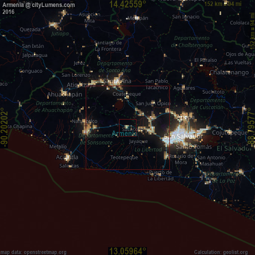
Analysis of Armenia night lights 2016
Square area 10x10 km:
 0%
0%90-99
0.21%80-89
1.45%70-79
0%60-69
0%50-59
3.31%40-49
0.83%30-39
1.65%20-29
0.83%10-19
0.83%0-9
90.91%Square area 50x50 km:
0.38%90-99
0.61%80-89
1%70-79
0.47%60-69
1.12%50-59
1.66%40-49
1.25%30-39
1.13%20-29
1.68%10-19
7.57%0-9
83.13%Clear (daylight) street map image can be seen on geolist.org.
Map coordinates:
14° 25' 32.1" North, 90° 12' 7.3" West
13° 44' 37" North, 89° 29' 56" West
13° 3' 34.7" North, 88° 47' 44.8" West
Some cities around Armenia sort by population:
• Santa Tecla
24.8 km =15.4 mi,  107°
107°
• Sonsonate
24.5 km =15.2 mi,  263°
263°
• Izalco
18.8 km =11.7 mi,  270°
270°
• Sonzacate
23.3 km =14.5 mi, 267°
• Ciudad Arce
12.1 km =7.5 mi,  27°
27°
• El Congo
18.4 km =11.4 mi,  1°
1°
• San Juan Opico
21 km =13 mi,  45°
45°
• Coatepeque
20.6 km =12.8 mi,  358°
358°
3587333 (p: 14,997)
Sources (retrieved 2019-11-25):
» Earth at Night: Flat Maps 2012, 2016