Pikine night lights from space
Night Light of Pikine (Dakar) from space (Senegal) Src. Average luminocity for 10x10km area is 68.6942% and for 50x50km: 12.5867%.
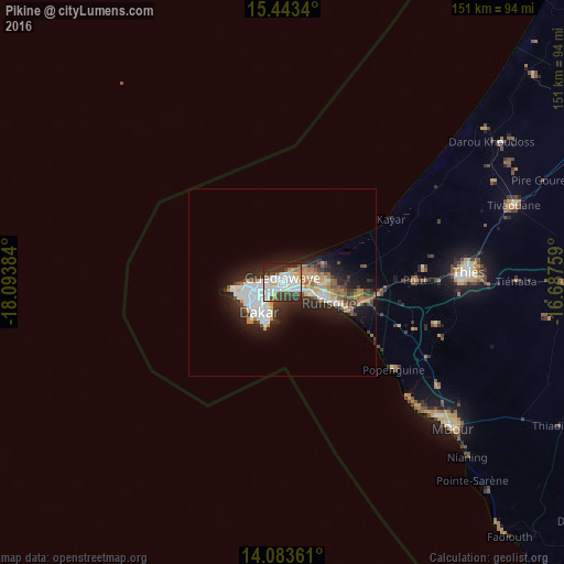
Analysis of Pikine night lights 2016
Square area 10x10 km:
 25%
25%90-99
19.42%80-89
7.23%70-79
5.37%60-69
2.07%50-59
2.48%40-49
9.5%30-39
9.71%20-29
16.74%10-19
2.48%0-9
0%Square area 50x50 km:
2.98%90-99
2.53%80-89
0.8%70-79
1.7%60-69
1.12%50-59
1.25%40-49
1.56%30-39
1.85%20-29
4.02%10-19
7.03%0-9
75.16%Clear (daylight) street map image can be seen on geolist.org.
Map coordinates:
15° 26' 36.2" North, 18° 5' 37.8" West
14° 45' 52.5" North, 17° 23' 26.6" West
14° 5' 1" North, 16° 41' 15.3" West
Some cities around Pikine sort by population:
• Dakar
9.7 km =6 mi,  216°
216°
• Thiès
50 km =31.1 mi,  86°
86°
• Thiès Nones
45.6 km =28.3 mi, 87°
• N’diareme limamoulaye
2 km =1.2 mi,  20°
20°
• Nguékhokh
50.1 km =31.1 mi,  123°
123°
• Pout
35.4 km =22 mi, 88°
• Kayar
33.8 km =21 mi,  59°
59°
• Mermoz Boabab
11.2 km =7 mi,  234°
234°
2246678 (p: 874,062)
Sources (retrieved 2019-11-25):
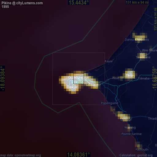
» NASA, Earths city lights 1995
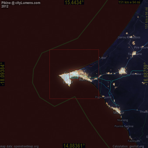
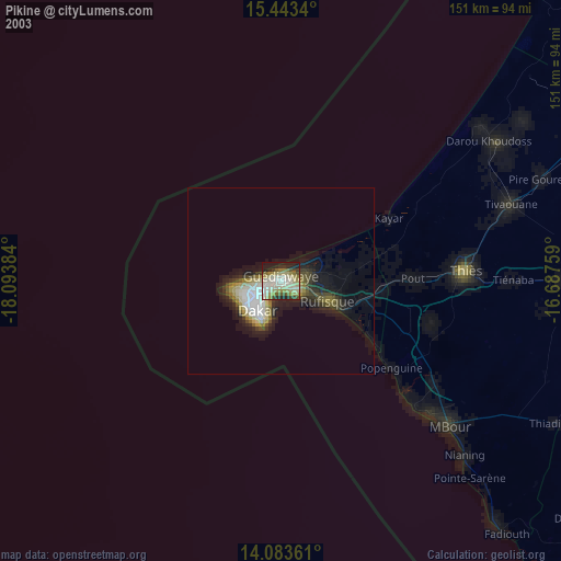
» NASA city lights 2003
» Earth at Night: Flat Maps 2012, 2016