Thiès Nones night lights from space
Night Light of Thiès Nones (Thiès) from space (Senegal) Src. Average luminocity for 10x10km area is 34.9339% and for 50x50km: 5.3198%.
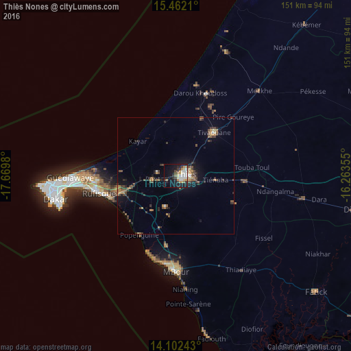
Analysis of Thiès Nones night lights 2016
Square area 10x10 km:
 6.4%
6.4%90-99
8.26%80-89
2.69%70-79
7.44%60-69
1.45%50-59
2.07%40-49
3.93%30-39
3.72%20-29
9.3%10-19
31.2%0-9
23.55%Square area 50x50 km:
0.31%90-99
0.49%80-89
0.39%70-79
0.96%60-69
0.7%50-59
0.71%40-49
1.31%30-39
1.23%20-29
1.26%10-19
3.75%0-9
88.88%Clear (daylight) street map image can be seen on geolist.org.
Map coordinates:
15° 27' 43.6" North, 17° 40' 11.3" West
14° 46' 60" North, 16° 58' 0" West
14° 6' 8.7" North, 16° 15' 48.8" West
Some cities around Thiès Nones sort by population:
• Pikine
45.6 km =28.3 mi,  267°
267°
• N’diareme limamoulaye
44.9 km =27.9 mi, 269°
• Mékhé
51.9 km =32.2 mi,  45°
45°
• Nguékhokh
30.4 km =18.9 mi,  187°
187°
• Pout
10.2 km =6.3 mi,  262°
262°
• Kayar
22.3 km =13.9 mi,  312°
312°
• Khombole
28.7 km =17.8 mi,  93°
93°
• Tiadiaye
49.9 km =31 mi,  144°
144°
2244799 (p: 252,320)
Sources (retrieved 2019-11-25):
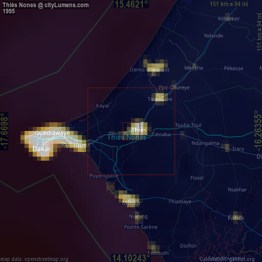
» NASA, Earths city lights 1995
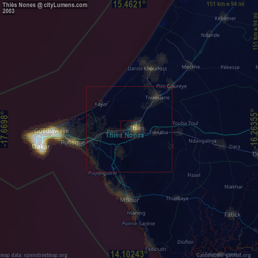
» NASA city lights 2003
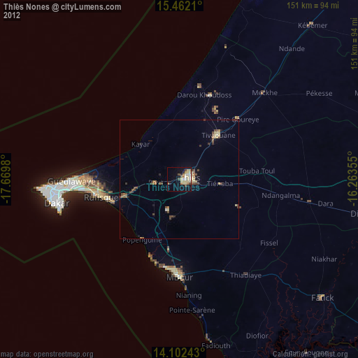
» Earth at Night: Flat Maps 2012, 2016