Thiès night lights from space
Night Light of Thiès from space (Senegal) Src. Average luminocity for 10x10km area is 48.3244% and for 50x50km: 4.7762%.
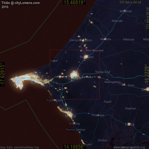

Analysis of Thiès night lights 2016
Square area 10x10 km:
 6.4%
6.4%90-99
9.92%80-89
7.23%70-79
11.36%60-69
2.69%50-59
5.58%40-49
9.3%30-39
8.47%20-29
8.68%10-19
28.51%0-9
1.86%Square area 50x50 km:
0.31%90-99
0.49%80-89
0.37%70-79
0.88%60-69
0.53%50-59
0.63%40-49
1.12%30-39
1.03%20-29
1.19%10-19
3.17%0-9
90.29%Clear (daylight) street map image can be seen on geolist.org.
Map coordinates:
15° 28' 5.5" North, 17° 37' 44.9" West
14° 47' 22" North, 16° 55' 33.7" West
14° 6' 30.8" North, 16° 13' 22.4" West
Some cities around Thiès sort by population:
• Pikine
50 km =31.1 mi,  266°
266°
• N’diareme limamoulaye
49.3 km =30.6 mi, 268°
• Mékhé
48.3 km =30 mi,  42°
42°
• Nguékhokh
31.9 km =19.8 mi,  195°
195°
• Pout
14.7 km =9.1 mi,  261°
261°
• Kayar
25.3 km =15.7 mi,  304°
304°
• Khombole
24.4 km =15.2 mi,  95°
95°
• Tiadiaye
48.1 km =29.9 mi,  149°
149°
2244802 (p: 320,000)
Sources (retrieved 2019-11-25):
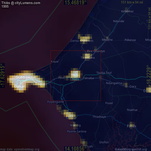
» NASA, Earths city lights 1995
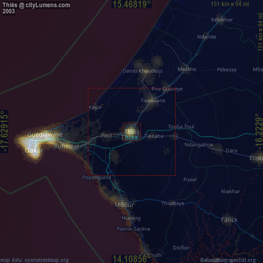
» NASA city lights 2003
» Earth at Night: Flat Maps 2012, 2016