Veľký Krtíš night lights from space
Night Light of Veľký Krtíš (Banskobystrický kraj) from space (Slovakia) Src. Average luminocity for 10x10km area is 2.9152% and for 50x50km: 0.9427%.
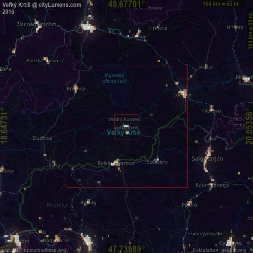
Analysis of Veľký Krtíš night lights 2016
Square area 10x10 km:
 0.45%
0.45%90-99
0.6%80-89
0.15%70-79
0%60-69
0.89%50-59
0.89%40-49
0.6%30-39
0%20-29
0.6%10-19
0%0-9
95.83%Square area 50x50 km:
0.06%90-99
0.12%80-89
0.09%70-79
0.12%60-69
0.2%50-59
0.16%40-49
0.29%30-39
0.08%20-29
0.3%10-19
0.06%0-9
98.52%Clear (daylight) street map image can be seen on geolist.org.
Map coordinates:
48° 40' 37.2" North, 18° 38' 50.3" East
48° 12' 38.1" North, 19° 21' 1.5" East
47° 44' 23.6" North, 20° 3' 12.8" East
Some cities around Veľký Krtíš sort by population:
• Salgótarján, HU
35.8 km =22.2 mi,  110°
110°
• Lučenec
27.1 km =16.8 mi,  59°
59°
• Balassagyarmat, HU
15.8 km =9.8 mi,  194°
194°
• Detva
39.3 km =24.4 mi,  7°
7°
• Fiľakovo
35.7 km =22.2 mi,  79°
79°
• Šahy
33.4 km =20.8 mi,  242°
242°
• Krupina
26.6 km =16.5 mi,  307°
307°
• Szécsény, HU
19.2 km =11.9 mi,  138°
138°
3056825 (p: 12,608)
Sources (retrieved 2019-11-25):
» Earth at Night: Flat Maps 2012, 2016