Trstená night lights from space
Night Light of Trstená (Žilinský kraj) from space (Slovakia) Src. Average luminocity for 10x10km area is 3.738% and for 50x50km: 0.9732%.
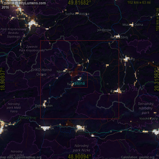
Analysis of Trstená night lights 2016
Square area 10x10 km:
 0.4%
0.4%90-99
0.67%80-89
0%70-79
0%60-69
1.74%50-59
0.67%40-49
1.2%30-39
0.13%20-29
0.53%10-19
0%0-9
94.65%Square area 50x50 km:
0.08%90-99
0.09%80-89
0.16%70-79
0.04%60-69
0.17%50-59
0.17%40-49
0.27%30-39
0.24%20-29
0.17%10-19
0.13%0-9
98.46%Clear (daylight) street map image can be seen on geolist.org.
Map coordinates:
49° 49' 0.6" North, 18° 54' 33.7" East
49° 21' 39.6" North, 19° 36' 45" East
48° 54' 3.4" North, 20° 18' 56.2" East
Some cities around Trstená sort by population:
• Nowy Targ, PL
33 km =20.5 mi,  66°
66°
• Liptovský Mikuláš
31.2 km =19.4 mi,  178°
178°
• Zakopane, PL
25.3 km =15.7 mi,  105°
105°
• Dolný Kubín
28 km =17.4 mi,  233°
233°
• Tvrdošín
4.9 km =3 mi,  236°
236°
• Námestovo
10.9 km =6.8 mi,  298°
298°
• Zawoja, PL
31.9 km =19.8 mi,  350°
350°
• Jordanów, PL
35.7 km =22.2 mi,  26°
26°
3057108 (p: 7,461)
Sources (retrieved 2019-11-25):
» Earth at Night: Flat Maps 2012, 2016