Čierny Balog night lights from space
Night Light of Čierny Balog (Banskobystrický kraj) from space (Slovakia) Src. Average luminocity for 10x10km area is 0.1324% and for 50x50km: 0.4272%.
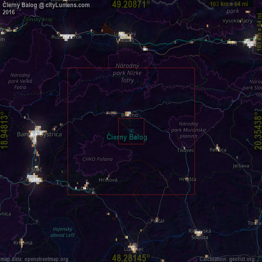
Analysis of Čierny Balog night lights 2016
Square area 10x10 km:
 0%
0%90-99
0%80-89
0%70-79
0%60-69
0%50-59
0%40-49
0%30-39
0%20-29
0%10-19
0%0-9
100%Square area 50x50 km:
0.02%90-99
0.04%80-89
0.04%70-79
0.03%60-69
0.1%50-59
0.13%40-49
0.12%30-39
0.07%20-29
0.11%10-19
0.07%0-9
99.26%Clear (daylight) street map image can be seen on geolist.org.
Map coordinates:
49° 12' 31.4" North, 18° 56' 53.3" East
48° 44' 50" North, 19° 39' 4.5" East
48° 16' 53.2" North, 20° 21' 15.8" East
Some cities around Čierny Balog sort by population:
• Banská Bystrica
36.5 km =22.7 mi,  268°
268°
• Liptovský Mikuláš
37.1 km =23.1 mi,  356°
356°
• Brezno
6.4 km =4 mi,  350°
350°
• Detva
26.8 km =16.7 mi,  219°
219°
• Revúca
34.9 km =21.7 mi,  101°
101°
• Hriňová
21 km =13 mi,  206°
206°
• Liptovský Hrádok
32.9 km =20.4 mi,  9°
9°
• Poltár
36.7 km =22.8 mi,  163°
163°
3060665 (p: 5,234)
Sources (retrieved 2019-11-25):
» Earth at Night: Flat Maps 2012, 2016