Slovenska Bistrica night lights from space
Night Light of Slovenska Bistrica from space (Slovenia) Src. Average luminocity for 10x10km area is 4.4509% and for 50x50km: 7.3357%.
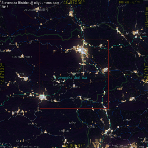
Analysis of Slovenska Bistrica night lights 2016
Square area 10x10 km:
 0.45%
0.45%90-99
0.74%80-89
0%70-79
0%60-69
0.89%50-59
0%40-49
1.79%30-39
1.49%20-29
0.89%10-19
0%0-9
93.75%Square area 50x50 km:
0.98%90-99
1.32%80-89
0.54%70-79
0.55%60-69
0.89%50-59
1.04%40-49
1.25%30-39
1.1%20-29
2.16%10-19
4.31%0-9
85.85%Clear (daylight) street map image can be seen on geolist.org.
Map coordinates:
46° 52' 32.1" North, 14° 52' 16.8" East
46° 23' 34" North, 15° 34' 28" East
45° 54' 20.4" North, 16° 16' 39.3" East
Some cities around Slovenska Bistrica sort by population:
• Miklavž na Dravskem Polju
15.7 km =9.8 mi,  36°
36°
• Zreče
15 km =9.3 mi,  265°
265°
• Spodnje Hoče
13.3 km =8.3 mi,  25°
25°
• Rače
10.5 km =6.5 mi,  51°
51°
• Oplotnica
9.8 km =6.1 mi, 266°
• Poljčane
9 km =5.6 mi,  177°
177°
• Majšperk
13 km =8.1 mi,  110°
110°
• Makole
11 km =6.8 mi,  139°
139°
3190534 (p: 7,454)
Sources (retrieved 2019-11-25):
» Earth at Night: Flat Maps 2012, 2016