Spodnje Hoče night lights from space
Night Light of Spodnje Hoče (Hoče-Slivnica) from space (Slovenia) Src. Average luminocity for 10x10km area is 37.5426% and for 50x50km: 6.308%.
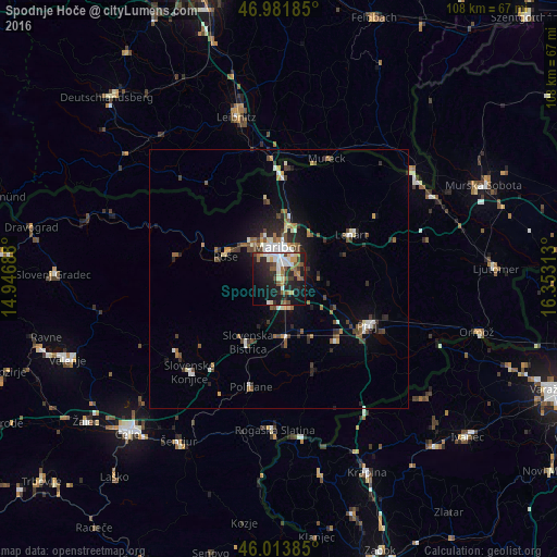
Analysis of Spodnje Hoče night lights 2016
Square area 10x10 km:
 5.82%
5.82%90-99
7.1%80-89
3.69%70-79
3.55%60-69
5.26%50-59
6.53%40-49
3.84%30-39
4.26%20-29
17.9%10-19
28.13%0-9
13.92%Square area 50x50 km:
0.74%90-99
1.03%80-89
0.47%70-79
0.46%60-69
0.81%50-59
1.03%40-49
1.14%30-39
0.98%20-29
1.95%10-19
3.33%0-9
88.06%Clear (daylight) street map image can be seen on geolist.org.
Map coordinates:
46° 58' 54.7" North, 14° 56' 48.8" East
46° 30' 0" North, 15° 39' 0" East
46° 0' 49.9" North, 16° 21' 11.3" East
Some cities around Spodnje Hoče sort by population:
• Maribor
6.1 km =3.8 mi,  357°
357°
• Slovenska Bistrica
13.3 km =8.3 mi,  205°
205°
• Ruše
11.2 km =7 mi,  293°
293°
• Miklavž na Dravskem Polju
3.7 km =2.3 mi,  79°
79°
• Rače
5.9 km =3.7 mi,  155°
155°
• Selnica ob Dravi
13.1 km =8.1 mi,  295°
295°
• Pesnica pri Mariboru
12.1 km =7.5 mi,  9°
9°
• Starše
9.7 km =6 mi,  112°
112°
3190219 (p: 2,555)
Sources (retrieved 2019-11-25):
» Earth at Night: Flat Maps 2012, 2016