Rogatec night lights from space
Night Light of Rogatec from space (Slovenia) Src. Average luminocity for 10x10km area is 4.942% and for 50x50km: 3.9521%.
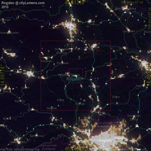
Analysis of Rogatec night lights 2016
Square area 10x10 km:
 0.45%
0.45%90-99
1.04%80-89
0.3%70-79
0.74%60-69
0.45%50-59
0%40-49
0.6%30-39
2.38%20-29
1.19%10-19
0.6%0-9
92.26%Square area 50x50 km:
0.41%90-99
0.55%80-89
0.23%70-79
0.44%60-69
0.46%50-59
0.52%40-49
0.72%30-39
0.85%20-29
1.02%10-19
0.9%0-9
93.9%Clear (daylight) street map image can be seen on geolist.org.
Map coordinates:
46° 42' 49.3" North, 14° 59' 49.8" East
46° 13' 46" North, 15° 42' 1" East
45° 44' 27.2" North, 16° 24' 12.3" East
Some cities around Rogatec sort by population:
• Rogaška Slatina
4.7 km =2.9 mi,  280°
280°
• Krapina, HR
15.7 km =9.8 mi,  119°
119°
• Šmarje pri Jelšah
13.9 km =8.6 mi,  268°
268°
• Poljčane
13.1 km =8.1 mi,  314°
314°
• Majšperk
13.8 km =8.6 mi,  10°
10°
• Podčetrtek
11.2 km =7 mi,  224°
224°
• Žetale
10.9 km =6.8 mi,  63°
63°
• Makole
10.1 km =6.3 mi,  345°
345°
3191578 (p: 1,558)
Sources (retrieved 2019-11-25):
» Earth at Night: Flat Maps 2012, 2016