Žetale night lights from space
Night Light of Žetale from space (Slovenia) Src. Average luminocity for 10x10km area is 3.0655% and for 50x50km: 4.1114%.
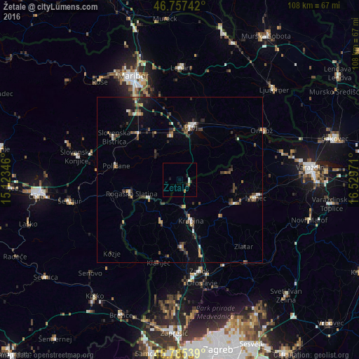
Analysis of Žetale night lights 2016
Square area 10x10 km:
 0.3%
0.3%90-99
0.89%80-89
0%70-79
0.6%60-69
0.6%50-59
0%40-49
0%30-39
0.74%20-29
1.04%10-19
0.6%0-9
95.24%Square area 50x50 km:
0.34%90-99
0.47%80-89
0.25%70-79
0.41%60-69
0.52%50-59
0.6%40-49
0.93%30-39
0.82%20-29
1.16%10-19
1.59%0-9
92.91%Clear (daylight) street map image can be seen on geolist.org.
Map coordinates:
46° 45' 26.7" North, 15° 7' 24.5" East
46° 16' 24.8" North, 15° 49' 35.7" East
45° 47' 7.4" North, 16° 31' 47" East
Some cities around Žetale sort by population:
• Rogaška Slatina
14.9 km =9.3 mi,  254°
254°
• Krapina, HR
13.2 km =8.2 mi,  162°
162°
• Rogatec
10.9 km =6.8 mi,  243°
243°
• Kidričevo
14.7 km =9.1 mi,  349°
349°
• Majšperk
11.2 km =7 mi,  320°
320°
• Videm pri Ptuju
12.2 km =7.6 mi,  30°
30°
• Podlehnik
8 km =5 mi, 30°
• Makole
13.2 km =8.2 mi,  291°
291°
3186557 (p: 392)
Sources (retrieved 2019-11-25):
» Earth at Night: Flat Maps 2012, 2016