Täby night lights from space
Night Light of Täby (Stockholm) from space (Sweden) Src. Average luminocity for 10x10km area is 70.0563% and for 50x50km: 36.4081%.
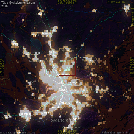
Analysis of Täby night lights 2016
Square area 10x10 km:
 16.67%
90-99
20.45%80-89
7.47%70-79
13.64%60-69
8.55%50-59
4.44%40-49
5.74%30-39
12.77%20-29
9.63%10-19
0.65%0-9
0%Square area 50x50 km:
10.71%90-99
8.99%80-89
2.86%70-79
3.47%60-69
3.25%50-59
3.38%40-49
4.14%30-39
3.63%20-29
6.66%10-19
15.84%0-9
37.09%Clear (daylight) street map image can be seen on geolist.org.
Map coordinates:
59° 47' 58.1" North, 17° 21' 56.2" East
59° 26' 38" North, 18° 4' 7.4" East
59° 5' 4.4" North, 18° 46' 18.7" East
Some cities around Täby sort by population:
• Sollentuna
6.9 km =4.3 mi,  255°
255°
• Lidingö
9.3 km =5.8 mi,  156°
156°
• Vallentuna
10.1 km =6.3 mi,  2°
2°
• Råsunda
9.6 km =6 mi,  205°
205°
• Kista
8.3 km =5.2 mi,  237°
237°
• Djursholm
5 km =3.1 mi,  188°
188°
• Akalla
9.3 km =5.8 mi,  249°
249°
• Bergshamra
7.3 km =4.5 mi,  195°
195°
2669772 (p: 58,123)
Sources (retrieved 2019-11-25):
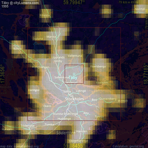
» NASA, Earths city lights 1995
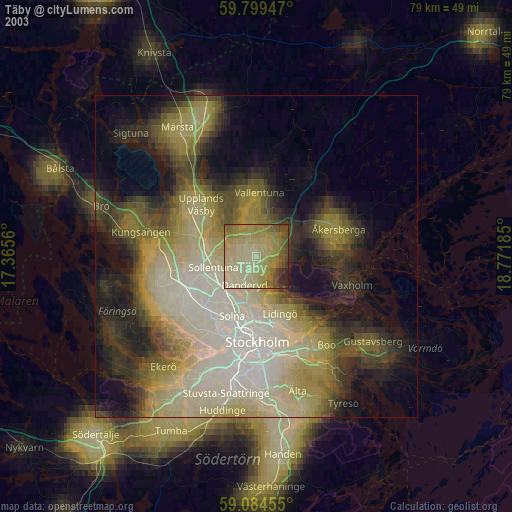
» NASA city lights 2003
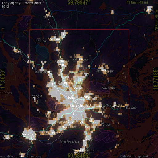
» Earth at Night: Flat Maps 2012, 2016