Råsunda night lights from space
Night Light of Råsunda (Stockholm) from space (Sweden) Src. Average luminocity for 10x10km area is 96.4232% and for 50x50km: 40.4961%.
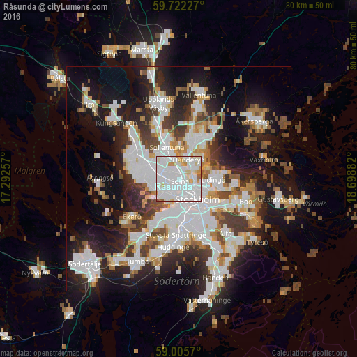
Analysis of Råsunda night lights 2016
Square area 10x10 km:
 51.84%
90-99
36.15%80-89
5.3%70-79
5.3%60-69
0.11%50-59
0.97%40-49
0.32%30-39
0%20-29
0%10-19
0%0-9
0%Square area 50x50 km:
12.21%90-99
9.93%80-89
2.95%70-79
3.57%60-69
3.54%50-59
3.66%40-49
4.29%30-39
4.44%20-29
8.84%10-19
17.89%0-9
28.69%Clear (daylight) street map image can be seen on geolist.org.
Map coordinates:
59° 43' 20.2" North, 17° 17' 33.3" East
59° 21' 57.2" North, 17° 59' 44.5" East
59° 0' 20.5" North, 18° 41' 55.8" East
Some cities around Råsunda sort by population:
• Kungsholmen
4.6 km =2.9 mi,  145°
145°
• Solna
0.7 km =0.4 mi,  155°
155°
• Bromma
4.3 km =2.7 mi,  227°
227°
• Vasastan
3.8 km =2.4 mi,  126°
126°
• Sundbyberg
1.5 km =0.9 mi,  249°
249°
• Kista
5 km =3.1 mi,  325°
325°
• Djursholm
5.1 km =3.2 mi,  42°
42°
• Bergshamra
2.7 km =1.7 mi,  52°
52°
2683034 (p: 16,877)
Sources (retrieved 2019-11-25):
» Earth at Night: Flat Maps 2012, 2016