Sollentuna night lights from space
Night Light of Sollentuna (Stockholm) from space (Sweden) Src. Average luminocity for 10x10km area is 79.2522% and for 50x50km: 37.7755%.
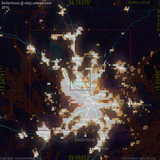
Analysis of Sollentuna night lights 2016
Square area 10x10 km:
 28.57%
90-99
23.38%80-89
4.98%70-79
13.31%60-69
4.33%50-59
4%40-49
12.55%30-39
8.77%20-29
0.11%10-19
0%0-9
0%Square area 50x50 km:
11.21%90-99
9.47%80-89
2.87%70-79
3.63%60-69
3.36%50-59
3.45%40-49
3.79%30-39
4.21%20-29
7.34%10-19
15.73%0-9
34.95%Clear (daylight) street map image can be seen on geolist.org.
Map coordinates:
59° 47' 1.6" North, 17° 14' 52.1" East
59° 25' 40.9" North, 17° 57' 3.3" East
59° 4' 6.7" North, 18° 39' 14.6" East
Some cities around Sollentuna sort by population:
• Täby
6.9 km =4.3 mi,  75°
75°
• Jakobsberg
6.6 km =4.1 mi,  264°
264°
• Tensta
4.7 km =2.9 mi,  216°
216°
• Råsunda
7.4 km =4.6 mi,  159°
159°
• Kista
2.8 km =1.7 mi,  187°
187°
• Djursholm
6.8 km =4.2 mi,  118°
118°
• Akalla
2.6 km =1.6 mi,  234°
234°
• Bergshamra
7.1 km =4.4 mi,  138°
138°
2675408 (p: 139,606)
Sources (retrieved 2019-11-25):
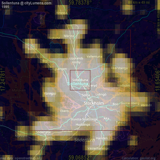
» NASA, Earths city lights 1995
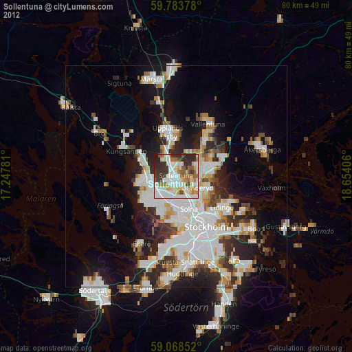
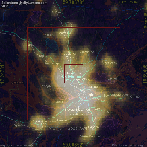
» NASA city lights 2003
» Earth at Night: Flat Maps 2012, 2016