Sayhāt night lights from space
Night Light of Sayhāt (Eastern Province) from space (Saudi Arabia) Src. Average luminocity for 10x10km area is 90.6402% and for 50x50km: 60.7032%.
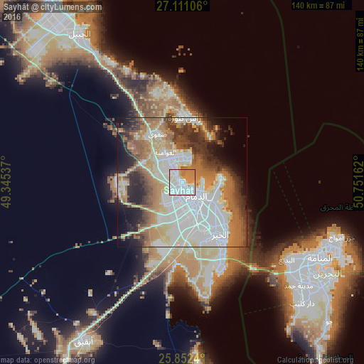
Analysis of Sayhāt night lights 2016
Square area 10x10 km:
 39.39%
90-99
28.79%80-89
4.55%70-79
14.96%60-69
12.31%50-59
0%40-49
0%30-39
0%20-29
0%10-19
0%0-9
0%Square area 50x50 km:
17.87%90-99
13.58%80-89
7.09%70-79
6.71%60-69
11.22%50-59
6.62%40-49
5.35%30-39
6.98%20-29
7.41%10-19
7.14%0-9
10.03%Clear (daylight) street map image can be seen on geolist.org.
Map coordinates:
27° 6' 39.8" North, 49° 20' 43.3" East
26° 29' 0.4" North, 50° 2' 54.6" East
25° 51' 8.6" North, 50° 45' 5.8" East
Some cities around Sayhāt sort by population:
• Dammam
7.7 km =4.8 mi,  134°
134°
• Dhahran
22.6 km =14 mi,  163°
163°
• Al Qaţīf
9.9 km =6.2 mi,  336°
336°
• Tārūt
10 km =6.2 mi,  355°
355°
• Şafwá
20.7 km =12.9 mi,  333°
333°
• Umm as Sāhik
23 km =14.3 mi, 325°
• Al Awjām
13.7 km =8.5 mi,  310°
310°
• At Tūbī
10 km =6.2 mi, 325°
102318 (p: 66,702)
Sources (retrieved 2019-11-25):
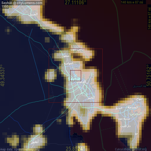
» NASA, Earths city lights 1995
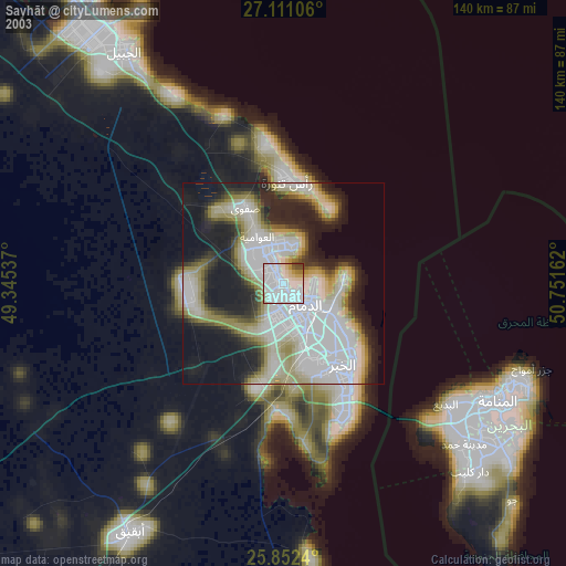
» NASA city lights 2003
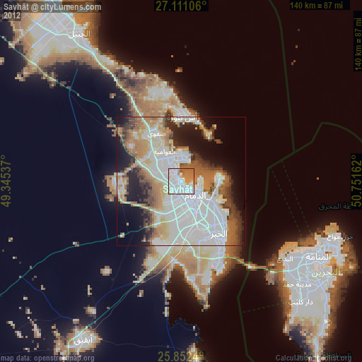
» Earth at Night: Flat Maps 2012, 2016