Dammam night lights from space
Night Light of Dammam (Eastern Province) from space (Saudi Arabia) Src. Average luminocity for 10x10km area is 97.5985% and for 50x50km: 60.927%.
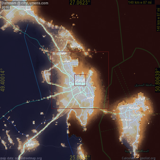
Analysis of Dammam night lights 2016
Square area 10x10 km:
 73.67%
90-99
17.42%80-89
4.17%70-79
3.22%60-69
1.52%50-59
0%40-49
0%30-39
0%20-29
0%10-19
0%0-9
0%Square area 50x50 km:
18.37%90-99
13.94%80-89
7.3%70-79
8.16%60-69
10.7%50-59
5.79%40-49
4.44%30-39
6.27%20-29
6.85%10-19
5.19%0-9
12.99%Clear (daylight) street map image can be seen on geolist.org.
Map coordinates:
27° 3' 44.3" North, 49° 24' 0.5" East
26° 26' 3.9" North, 50° 6' 11.7" East
25° 48' 11.2" North, 50° 48' 23" East
Fantastic image of Dammam from space taken by astronauts [src2], but I don't have information about it's orientation, scale or angle. If necessary, it was rotated manually, so North points approximately to upper direction. Click to zoom in:

Some cities around Dammam sort by population:
• Khobar
20.2 km =12.6 mi,  148°
148°
• Dhahran
16.2 km =10.1 mi,  176°
176°
• Al Qa≈£ƒ´f
17.3 km =10.7 mi,  327°
327°
• TƒÅr≈´t
16.7 km =10.4 mi,  337°
337°
• SayhƒÅt
7.7 km =4.8 mi,  314°
314°
• ≈ûafw√°
28.1 km =17.5 mi, 328°
• Al AwjƒÅm
21.4 km =13.3 mi, 311°
• At T≈´bƒ´
17.6 km =10.9 mi,  321°
321°
110336 (p: 768,602)
Sources (retrieved 2019-11-25):
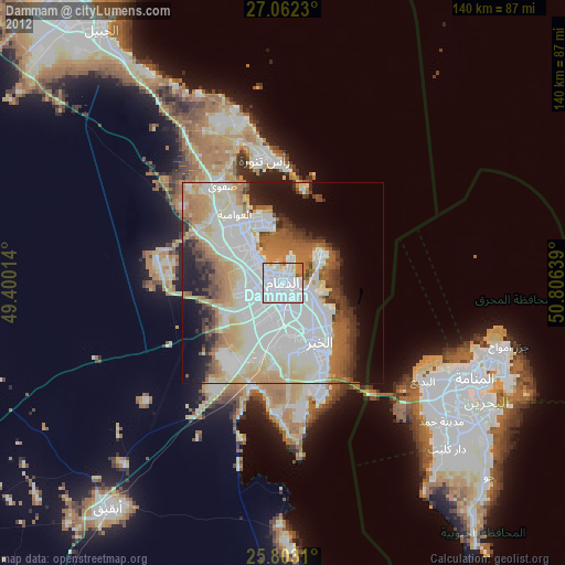
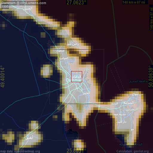
» NASA, Earths city lights 1995
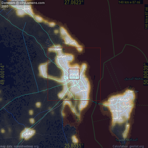
» NASA city lights 2003
» Earth at Night: Flat Maps 2012, 2016
Src.2: picture by Oleg Kononenko,ÝRoscosmos, retrieved 2019-11-29