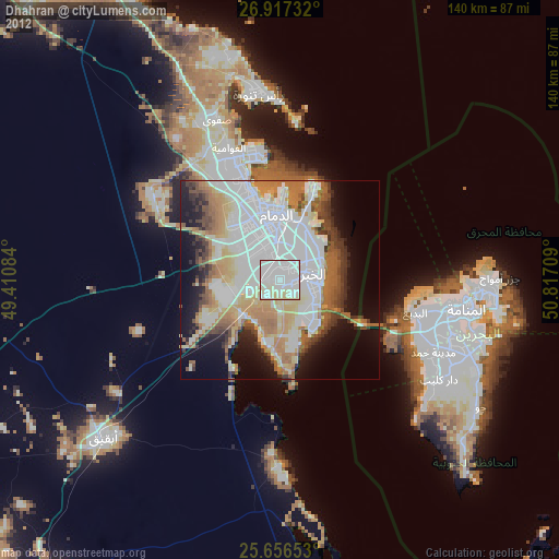
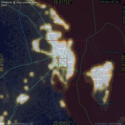
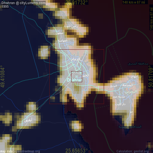
Dhahran night lights from space
Night Light of Dhahran (Eastern Province) from space (Saudi Arabia) Src. Average luminocity for 10x10km area is 94.5278% and for 50x50km: 59.0329%.
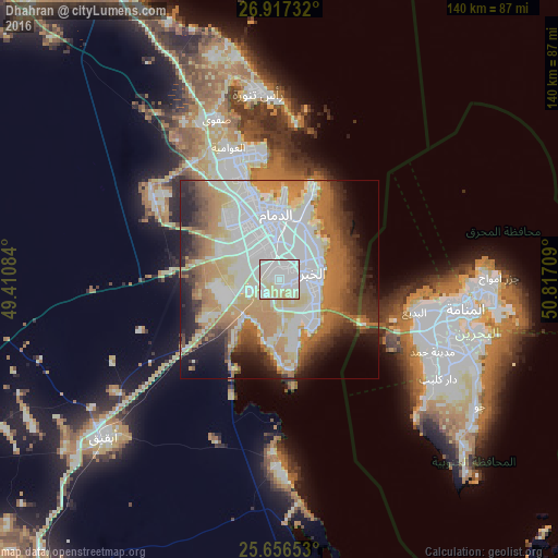
Analysis of Dhahran night lights 2016
Square area 10x10 km:
 39.29%
90-99
35.91%80-89
21.63%70-79
3.17%60-69
0%50-59
0%40-49
0%30-39
0%20-29
0%10-19
0%0-9
0%Square area 50x50 km:
17.48%90-99
12.77%80-89
6.82%70-79
8.15%60-69
11.62%50-59
5.33%40-49
3.96%30-39
6.01%20-29
6.84%10-19
7.97%0-9
13.04%Clear (daylight) street map image can be seen on geolist.org.
Map coordinates:
26° 55' 2.4" North, 49° 24' 39" East
26° 17' 19.1" North, 50° 6' 50.3" East
25° 39' 23.5" North, 50° 49' 1.5" East
Some cities around Dhahran sort by population:
• Dammam
16.2 km =10.1 mi,  356°
356°
• Khobar
9.5 km =5.9 mi,  96°
96°
• Al Qaţīf
32.5 km =20.2 mi,  341°
341°
• Tārūt
32.5 km =20.2 mi,  346°
346°
• Sayhāt
22.6 km =14 mi, 343°
• Şafwá
43.1 km =26.8 mi, 338°
• Al Awjām
34.9 km =21.7 mi,  330°
330°
• At Tūbī
32.3 km =20.1 mi, 337°
107797 (p: 99,540)
Sources (retrieved 2019-11-25):
» NASA, Earths city lights 1995
» NASA city lights 2003
» Earth at Night: Flat Maps 2012, 2016