Şāmitah night lights from space
Night Light of Şāmitah (Jizan) from space (Saudi Arabia) Src. Average luminocity for 10x10km area is 87.9372% and for 50x50km: 40.0358%.
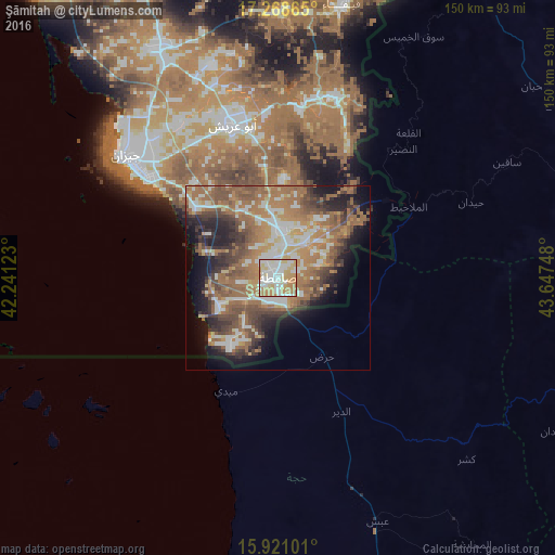
Analysis of Şāmitah night lights 2016
Square area 10x10 km:
 26.62%
90-99
29%80-89
12.34%70-79
21.86%60-69
10.17%50-59
0%40-49
0%30-39
0%20-29
0%10-19
0%0-9
0%Square area 50x50 km:
5.48%90-99
6.71%80-89
3.6%70-79
5.63%60-69
12.4%50-59
8.52%40-49
6.56%30-39
5.79%20-29
6.08%10-19
9.24%0-9
29.99%Clear (daylight) street map image can be seen on geolist.org.
Map coordinates:
17° 16' 7.1" North, 42° 14' 28.4" East
16° 35' 45.6" North, 42° 56' 39.7" East
15° 55' 15.6" North, 43° 38' 50.9" East
Some cities around Şāmitah sort by population:
• Jizan
53.1 km =33 mi,  307°
307°
• Şabyā
70.3 km =43.7 mi,  331°
331°
• Sa'dah, YE
95.3 km =59.2 mi,  66°
66°
• Abū ‘Arīsh
43.1 km =26.8 mi,  343°
343°
• Farasān
88.8 km =55.2 mi,  277°
277°
• Al Jarādīyah
3.9 km =2.4 mi,  241°
241°
• Mislīyah
104.5 km =64.9 mi, 336°
• Mizhirah
34.1 km =21.2 mi,  318°
318°
102451 (p: 26,945)
Sources (retrieved 2019-11-25):
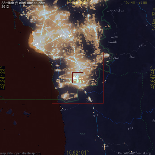
» Earth at Night: Flat Maps 2012, 2016