Khobar night lights from space
Night Light of Khobar (Eastern Province) from space (Saudi Arabia) Src. Average luminocity for 10x10km area is 88.2738% and for 50x50km: 53.883%.
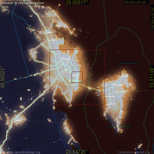
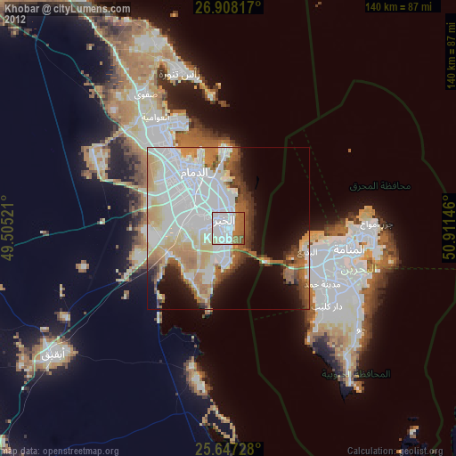
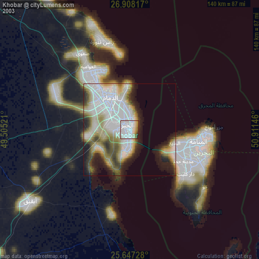
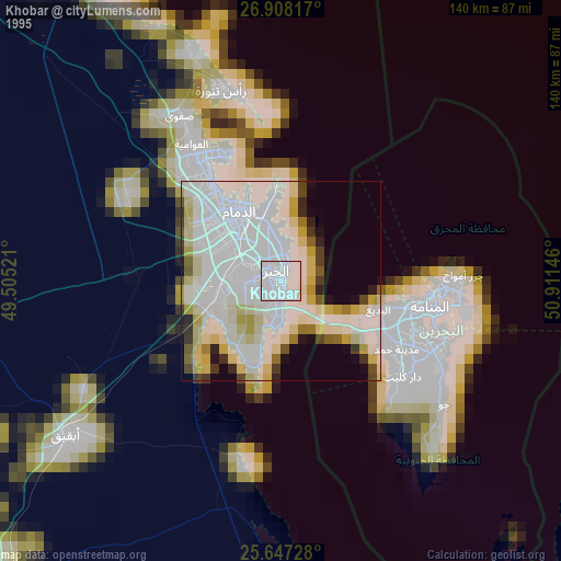
Analysis of Khobar night lights 2016
Square area 10x10 km:
 38.89%
90-99
20.04%80-89
8.93%70-79
14.68%60-69
17.46%50-59
0%40-49
0%30-39
0%20-29
0%10-19
0%0-9
0%Square area 50x50 km:
17.26%90-99
11.77%80-89
6.34%70-79
6.94%60-69
9.59%50-59
4.2%40-49
3.68%30-39
5.76%20-29
5.5%10-19
6.43%0-9
22.55%Clear (daylight) street map image can be seen on geolist.org.
Map coordinates:
26° 54' 29.4" North, 49° 30' 18.8" East
26° 16' 46" North, 50° 12' 30" East
25° 38' 50.2" North, 50° 54' 41.3" East
Some cities around Khobar sort by population:
• Dammam
20.2 km =12.6 mi,  328°
328°
• Dhahran
9.5 km =5.9 mi,  276°
276°
• Al Qaţīf
37.5 km =23.3 mi, 328°
• Tārūt
36.7 km =22.8 mi, 332°
• Sayhāt
27.7 km =17.2 mi,  324°
324°
• Madīnat Ḩamad, BH
34.9 km =21.7 mi,  121°
121°
• Madīnat ‘Īsá, BH
35.8 km =22.2 mi,  109°
109°
• Jidd Ḩafş, BH
34.5 km =21.4 mi,  101°
101°
109323 (p: 165,799)
Sources (retrieved 2019-11-25):
» NASA, Earths city lights 1995
» NASA city lights 2003
» Earth at Night: Flat Maps 2012, 2016