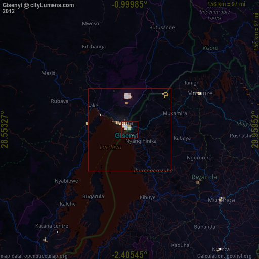
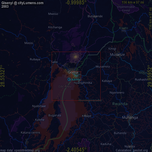
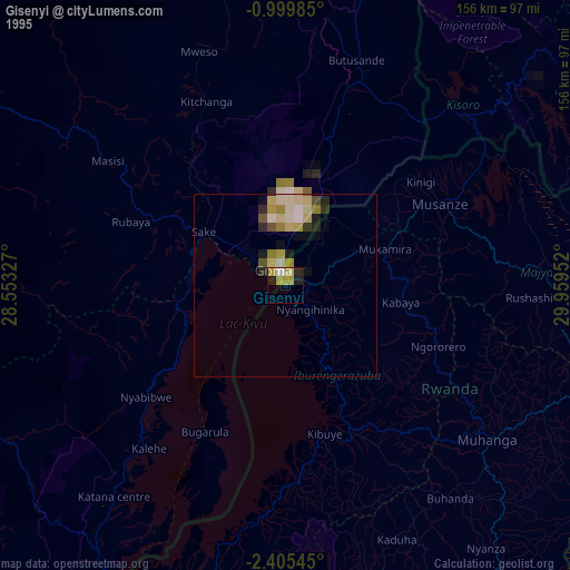
Gisenyi night lights from space
Night Light of Gisenyi (Western Province) from space (Rwanda) Src. Average luminocity for 10x10km area is 18.0714% and for 50x50km: 2.0959%.
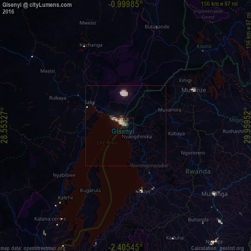
Analysis of Gisenyi night lights 2016
Square area 10x10 km:
 1.73%
1.73%90-99
2.16%80-89
2.16%70-79
2.6%60-69
3.46%50-59
4.55%40-49
1.52%30-39
3.9%20-29
2.6%10-19
6.49%0-9
68.83%Square area 50x50 km:
0.29%90-99
0.33%80-89
0.15%70-79
0.18%60-69
0.32%50-59
0.29%40-49
0.12%30-39
0.55%20-29
0.29%10-19
0.93%0-9
96.54%Clear (daylight) street map image can be seen on geolist.org.
Map coordinates:
0° 59' 59.5" South, 28° 33' 11.8" East
1° 42' 10" South, 29° 15' 23" East
2° 24' 19.6" South, 29° 57' 34.3" East
Some cities around Gisenyi sort by population:
• Goma, CD
4.5 km =2.8 mi,  315°
315°
• Gitarama
69.3 km =43.1 mi,  126°
126°
• Musanze
47.7 km =29.6 mi,  61°
61°
• Byumba
91.2 km =56.7 mi,  81°
81°
• Kibuye
41 km =25.5 mi,  165°
165°
• Sake, CD
27.7 km =17.2 mi,  301°
301°
• Kisoro, UG
66.5 km =41.3 mi,  45°
45°
• Nyanza
90.7 km =56.4 mi,  142°
142°
202905 (p: 83,623)
Sources (retrieved 2019-11-25):
» NASA, Earths city lights 1995
» NASA city lights 2003
» Earth at Night: Flat Maps 2012, 2016