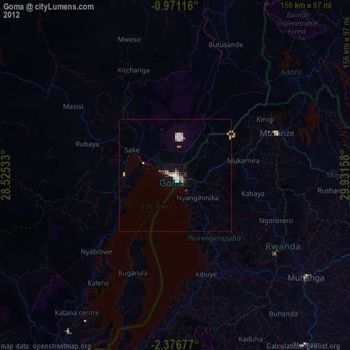
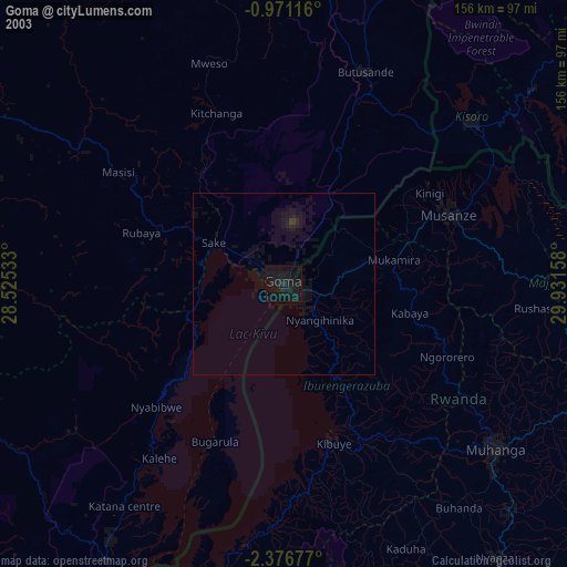
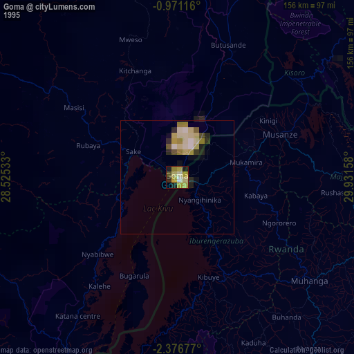
Goma night lights from space
Night Light of Goma (Nord Kivu) from space (Democratic Republic of the Congo) Src. Average luminocity for 10x10km area is 25.1429% and for 50x50km: 2.116%.
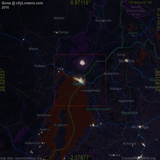
Analysis of Goma night lights 2016
Square area 10x10 km:
 1.73%
1.73%90-99
2.16%80-89
2.16%70-79
3.68%60-69
6.28%50-59
6.71%40-49
2.81%30-39
6.06%20-29
4.33%10-19
12.99%0-9
51.08%Square area 50x50 km:
0.29%90-99
0.33%80-89
0.15%70-79
0.18%60-69
0.32%50-59
0.29%40-49
0.12%30-39
0.55%20-29
0.29%10-19
0.93%0-9
96.54%Clear (daylight) street map image can be seen on geolist.org.
Map coordinates:
0° 58' 16.2" South, 28° 31' 31.2" East
1° 40' 26.7" South, 29° 13' 42.4" East
2° 22' 36.4" South, 29° 55' 53.7" East
Some cities around Goma sort by population:
• Gitarama, RW
73.7 km =45.8 mi,  127°
127°
• Musanze, RW
49.2 km =30.6 mi,  66°
66°
• Gisenyi, RW
4.5 km =2.8 mi,  135°
135°
• Byumba, RW
93.9 km =58.3 mi,  83°
83°
• Kibuye, RW
44.9 km =27.9 mi,  162°
162°
• Sake
23.4 km =14.5 mi,  298°
298°
• Kisoro, UG
66.7 km =41.4 mi,  49°
49°
• Nyanza, RW
95.1 km =59.1 mi, 142°
216281 (p: 144,124)
Sources (retrieved 2019-11-25):
» NASA, Earths city lights 1995
» NASA city lights 2003
» Earth at Night: Flat Maps 2012, 2016