Zlatoust night lights from space
Night Light of Zlatoust (Chelyabinsk) from space (Russia) Src. Average luminocity for 10x10km area is 37.104% and for 50x50km: 2.7914%.
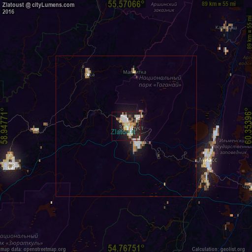
Analysis of Zlatoust night lights 2016
Square area 10x10 km:
 5.76%
5.76%90-99
9.52%80-89
4.14%70-79
5.76%60-69
4.01%50-59
2.88%40-49
2.51%30-39
1.88%20-29
18.17%10-19
22.43%0-9
22.93%Square area 50x50 km:
0.37%90-99
0.58%80-89
0.26%70-79
0.37%60-69
0.3%50-59
0.29%40-49
0.3%30-39
0.13%20-29
0.77%10-19
2.41%0-9
94.22%Clear (daylight) street map image can be seen on geolist.org.
Map coordinates:
55° 34' 14.4" North, 58° 56' 51.8" East
55° 10' 16" North, 59° 39' 3" East
54° 46' 3" North, 60° 21' 14.3" East
Some cities around Zlatoust sort by population:
• Miass
32.3 km =20.1 mi,  115°
115°
• Satka
41.4 km =25.7 mi,  249°
249°
• Chebarkul’
50.3 km =31.3 mi, 115°
• Bakal
59.4 km =36.9 mi,  244°
244°
• Kusa
22.9 km =14.2 mi,  324°
324°
• Karabash
49.6 km =30.8 mi,  46°
46°
• Magnitka
19.8 km =12.3 mi,  8°
8°
• Berdyaush
32.1 km =19.9 mi,  268°
268°
462444 (p: 191,366)
Sources (retrieved 2019-11-25):
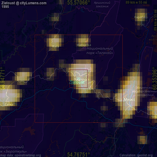
» NASA, Earths city lights 1995
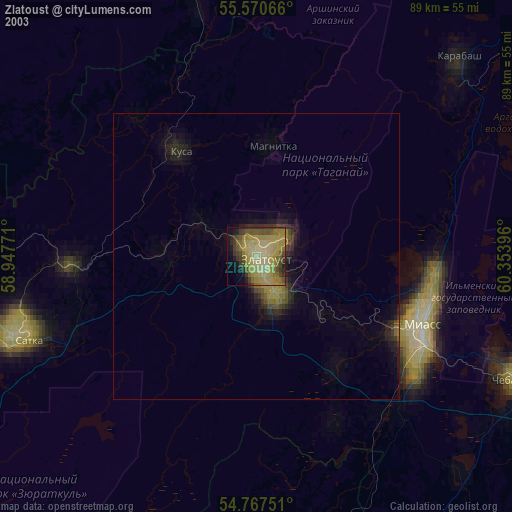
» NASA city lights 2003
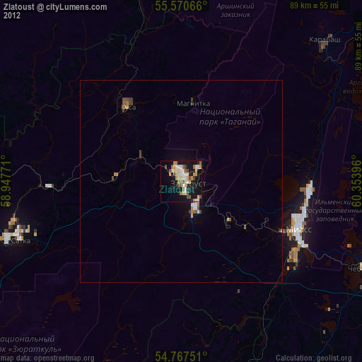
» Earth at Night: Flat Maps 2012, 2016