Satka night lights from space
Night Light of Satka (Chelyabinsk) from space (Russia) Src. Average luminocity for 10x10km area is 29.104% and for 50x50km: 2.3017%.

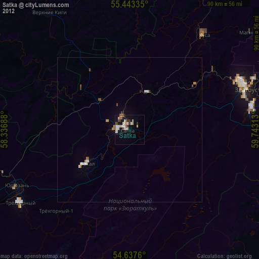
Analysis of Satka night lights 2016
Square area 10x10 km:
 5.39%
5.39%90-99
9.9%80-89
4.51%70-79
2.01%60-69
1%50-59
2.13%40-49
0.75%30-39
2.26%20-29
6.52%10-19
22.56%0-9
42.98%Square area 50x50 km:
0.26%90-99
0.56%80-89
0.29%70-79
0.2%60-69
0.24%50-59
0.3%40-49
0.21%30-39
0.14%20-29
0.32%10-19
1.75%0-9
95.71%Clear (daylight) street map image can be seen on geolist.org.
Map coordinates:
55° 26' 36.1" North, 58° 20' 12.8" East
55° 2' 33" North, 59° 2' 24" East
54° 38' 15.4" North, 59° 44' 35.3" East
Some cities around Satka sort by population:
• Zlatoust
41.4 km =25.7 mi,  69°
69°
• Trëkhgornyy
44.9 km =27.9 mi,  235°
235°
• Bakal
18.5 km =11.5 mi,  232°
232°
• Kusa
41.6 km =25.8 mi,  37°
37°
• Yuryuzan’
44.2 km =27.5 mi, 243°
• Verkhniye Kigi
49.2 km =30.6 mi,  325°
325°
• Magnitka
53.7 km =33.4 mi,  50°
50°
• Berdyaush
14.9 km =9.3 mi,  27°
27°
498418 (p: 49,384)
Sources (retrieved 2019-11-25):
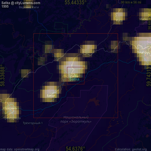
» NASA, Earths city lights 1995
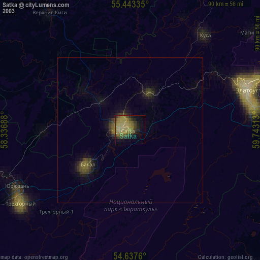
» NASA city lights 2003
» Earth at Night: Flat Maps 2012, 2016