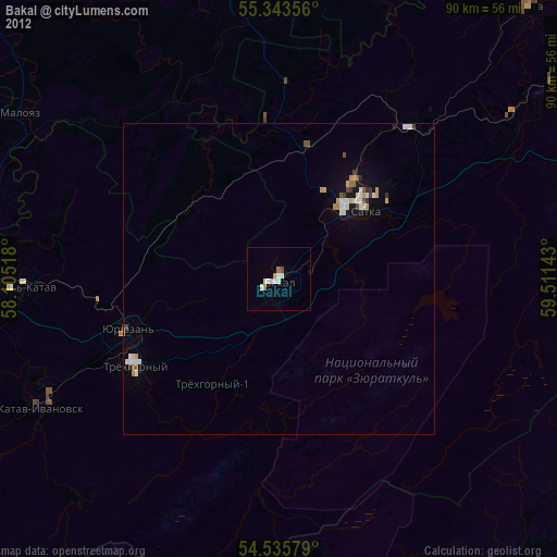
Bakal night lights from space
Night Light of Bakal (Chelyabinsk) from space (Russia) Src. Average luminocity for 10x10km area is 6.8983% and for 50x50km: 2.6321%.
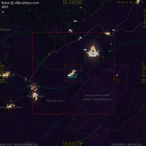
Analysis of Bakal night lights 2016
Square area 10x10 km:
 0.72%
0.72%90-99
1.08%80-89
0.84%70-79
1.32%60-69
1.79%50-59
0.72%40-49
0.72%30-39
0%20-29
0.48%10-19
0%0-9
92.34%Square area 50x50 km:
0.36%90-99
0.57%80-89
0.38%70-79
0.29%60-69
0.24%50-59
0.27%40-49
0.22%30-39
0.17%20-29
0.29%10-19
2.18%0-9
95.04%Clear (daylight) street map image can be seen on geolist.org.
Map coordinates:
55° 20' 36.8" North, 58° 6' 18.6" East
54° 56' 30.1" North, 58° 48' 29.9" East
54° 32' 8.8" North, 59° 30' 41.1" East
Some cities around Bakal sort by population:
• Satka
18.5 km =11.5 mi,  52°
52°
• Trëkhgornyy
26.4 km =16.4 mi,  237°
237°
• Ust’-Katav
40.4 km =25.1 mi,  269°
269°
• Katav-Ivanovsk
44.5 km =27.7 mi, 241°
• Yuryuzan’
26.2 km =16.3 mi,  250°
250°
• Verkhniye Kigi
53.5 km =33.2 mi,  345°
345°
• Berdyaush
32.6 km =20.3 mi,  41°
41°
• Kropachëvo
52.8 km =32.8 mi,  278°
278°
579738 (p: 21,762)
Sources (retrieved 2019-11-25):
» Earth at Night: Flat Maps 2012, 2016