Zalukokoazhe night lights from space
Night Light of Zalukokoazhe (Kabardino-Balkariya Republic) from space (Russia) Src. Average luminocity for 10x10km area is 1.9079% and for 50x50km: 3.9272%.
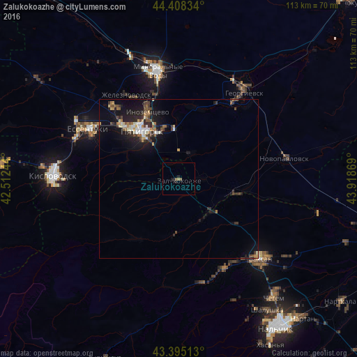
Analysis of Zalukokoazhe night lights 2016
Square area 10x10 km:
 0%
0%90-99
0%80-89
0%70-79
0%60-69
1.43%50-59
0.48%40-49
0%30-39
0%20-29
1.59%10-19
0.95%0-9
95.56%Square area 50x50 km:
0.37%90-99
0.55%80-89
0.35%70-79
0.42%60-69
0.51%50-59
0.49%40-49
0.71%30-39
0.79%20-29
1.07%10-19
3.89%0-9
90.85%Clear (daylight) street map image can be seen on geolist.org.
Map coordinates:
44° 24' 30" North, 42° 30' 44.8" East
43° 54' 14" North, 43° 12' 56" East
43° 23' 42.5" North, 43° 55' 7.3" East
Some cities around Zalukokoazhe sort by population:
• Pyatigorsk
20.4 km =12.7 mi,  322°
322°
• Goryachevodskiy
16.6 km =10.3 mi, 323°
• Svobody
18.9 km =11.7 mi, 315°
• Sarmakovo
17.6 km =10.9 mi,  183°
183°
• Yutsa
17.3 km =10.7 mi,  289°
289°
• Malka
14.1 km =8.8 mi,  141°
141°
• Konstantinovskaya
16.4 km =10.2 mi,  343°
343°
• Kamennomostskoye
22.7 km =14.1 mi,  215°
215°
465174 (p: 9,997)
Sources (retrieved 2019-11-25):
» Earth at Night: Flat Maps 2012, 2016