Pyatigorsk night lights from space
Night Light of Pyatigorsk (Stavropol’ Kray) from space (Russia) Src. Average luminocity for 10x10km area is 47.7429% and for 50x50km: 7.0097%.
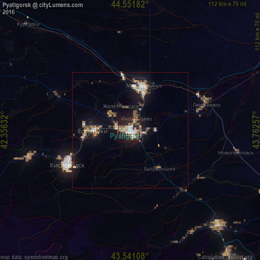

Analysis of Pyatigorsk night lights 2016
Square area 10x10 km:
 8.1%
8.1%90-99
11.27%80-89
4.44%70-79
5.87%60-69
5.24%50-59
5.71%40-49
6.67%30-39
8.57%20-29
18.73%10-19
24.76%0-9
0.63%Square area 50x50 km:
0.77%90-99
1.14%80-89
0.54%70-79
0.75%60-69
0.8%50-59
0.98%40-49
1.03%30-39
0.93%20-29
1.54%10-19
7.63%0-9
83.88%Clear (daylight) street map image can be seen on geolist.org.
Map coordinates:
44° 33' 6.6" North, 42° 21' 22.8" East
44° 2' 55" North, 43° 3' 34" East
43° 32' 27.9" North, 43° 45' 45.3" East
Some cities around Pyatigorsk sort by population:
• Goryachevodskiy
3.8 km =2.4 mi,  136°
136°
• Inozemtsevo
5.5 km =3.4 mi,  27°
27°
• Zheleznovodsk
10.6 km =6.6 mi,  342°
342°
• Lermontov
9.4 km =5.8 mi,  313°
313°
• Svobody
2.7 km =1.7 mi,  195°
195°
• Vinsady
8.3 km =5.2 mi,  295°
295°
• Yutsa
10.9 km =6.8 mi, 199°
• Konstantinovskaya
7.9 km =4.9 mi,  92°
92°
503550 (p: 142,865)
Sources (retrieved 2019-11-25):
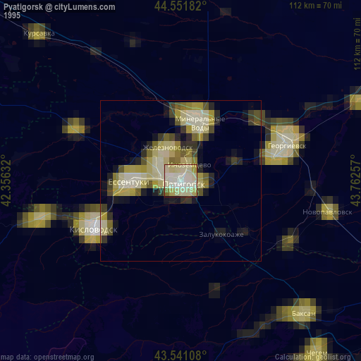
» NASA, Earths city lights 1995
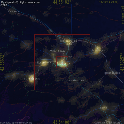
» NASA city lights 2003
» Earth at Night: Flat Maps 2012, 2016