Konstantinovskaya night lights from space
Night Light of Konstantinovskaya (Stavropol’ Kray) from space (Russia) Src. Average luminocity for 10x10km area is 18.3413% and for 50x50km: 6.5497%.
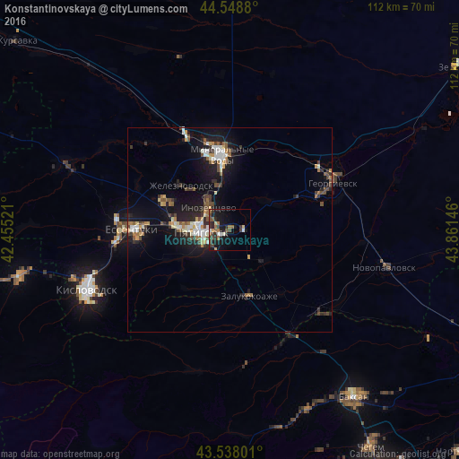
Analysis of Konstantinovskaya night lights 2016
Square area 10x10 km:
 1.43%
1.43%90-99
1.75%80-89
1.27%70-79
0.95%60-69
3.81%50-59
2.7%40-49
4.29%30-39
6.51%20-29
4.6%10-19
18.89%0-9
53.81%Square area 50x50 km:
0.73%90-99
1.05%80-89
0.48%70-79
0.71%60-69
0.78%50-59
0.92%40-49
1.08%30-39
1.07%20-29
1.58%10-19
6.42%0-9
85.19%Clear (daylight) street map image can be seen on geolist.org.
Map coordinates:
44° 32' 55.7" North, 42° 27' 18.8" East
44° 2' 44" North, 43° 9' 30" East
43° 32' 16.8" North, 43° 51' 41.3" East
Some cities around Konstantinovskaya sort by population:
• Pyatigorsk
7.9 km =4.9 mi,  272°
272°
• Goryachevodskiy
5.8 km =3.6 mi,  245°
245°
• Inozemtsevo
7.5 km =4.7 mi,  314°
314°
• Zheleznovodsk
15.2 km =9.4 mi, 313°
• Svobody
8.9 km =5.5 mi,  255°
255°
• Lysogorskaya
11.6 km =7.2 mi,  54°
54°
• Vinsady
15.9 km =9.9 mi,  284°
284°
• Yutsa
15.3 km =9.5 mi,  229°
229°
545276 (p: 7,137)
Sources (retrieved 2019-11-25):
» Earth at Night: Flat Maps 2012, 2016