Tsiolkovskiy night lights from space
Night Light of Tsiolkovskiy (Amur Oblast) from space (Russia) Src. Average luminocity for 10x10km area is 7.268% and for 50x50km: 0.4603%.
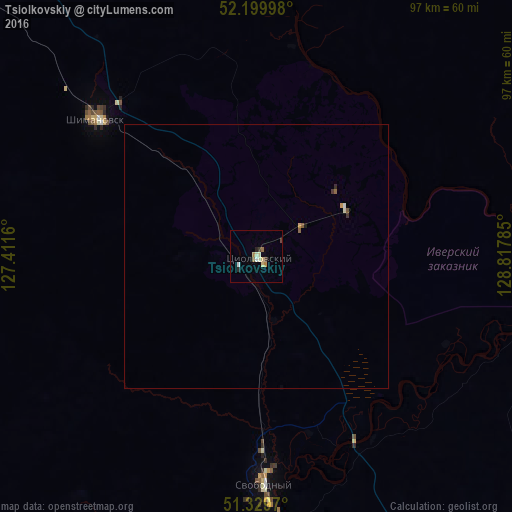
Analysis of Tsiolkovskiy night lights 2016
Square area 10x10 km:
 0.68%
0.68%90-99
1.9%80-89
1.22%70-79
0.95%60-69
0.54%50-59
0.68%40-49
1.09%30-39
0.54%20-29
1.09%10-19
0%0-9
91.29%Square area 50x50 km:
0.04%90-99
0.11%80-89
0.05%70-79
0.08%60-69
0.03%50-59
0.11%40-49
0.04%30-39
0.06%20-29
0.06%10-19
0.02%0-9
99.4%Clear (daylight) street map image can be seen on geolist.org.
Map coordinates:
52° 11' 59.9" North, 127° 24' 41.8" East
51° 46' 1" North, 128° 6' 53" East
51° 19' 46.9" North, 128° 49' 4.3" East
Some cities around Tsiolkovskiy sort by population:
• Blagoveshchensk
170.2 km =105.8 mi,  193°
193°
• Heihe, CN
174.9 km =108.7 mi, 194°
• Belogorsk
97.9 km =60.8 mi,  165°
165°
• Svobodnyy
43.6 km =27.1 mi,  177°
177°
• Shimanovsk
40.1 km =24.9 mi,  311°
311°
• Seryshevo
77.1 km =47.9 mi, 166°
• Yekaterinoslavka
169.8 km =105.5 mi,  155°
155°
• Srednebelaya
123.5 km =76.7 mi, 183°
6641869 (p: 6,535)
Sources (retrieved 2019-11-25):
» Earth at Night: Flat Maps 2012, 2016