Seryshevo night lights from space
Night Light of Seryshevo (Amur Oblast) from space (Russia) Src. Average luminocity for 10x10km area is 2.9011% and for 50x50km: 2.0462%.
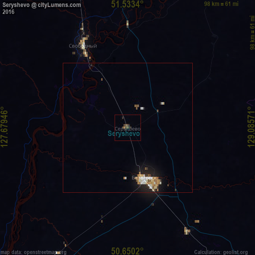
Analysis of Seryshevo night lights 2016
Square area 10x10 km:
 0%
0%90-99
0%80-89
0%70-79
0.53%60-69
0%50-59
0.27%40-49
2.54%30-39
1.07%20-29
1.47%10-19
0.53%0-9
93.58%Square area 50x50 km:
0.25%90-99
0.33%80-89
0.27%70-79
0.18%60-69
0.42%50-59
0.2%40-49
0.29%30-39
0.22%20-29
0.4%10-19
1.67%0-9
95.76%Clear (daylight) street map image can be seen on geolist.org.
Map coordinates:
51° 32' 0.2" North, 127° 40' 46.1" East
51° 5' 38.1" North, 128° 22' 57.3" East
50° 39' 0.7" North, 129° 5' 8.6" East
Some cities around Seryshevo sort by population:
• Blagoveshchensk
108.2 km =67.2 mi,  213°
213°
• Belogorsk
20.8 km =12.9 mi,  161°
161°
• Svobodnyy
35.5 km =22.1 mi,  331°
331°
• Shimanovsk
112.5 km =69.9 mi, 334°
• Yekaterinoslavka
95.1 km =59.1 mi,  147°
147°
• Tambovka
112.9 km =70.2 mi,  191°
191°
• Tsiolkovskiy
77.1 km =47.9 mi,  346°
346°
• Srednebelaya
55 km =34.2 mi, 208°
2016942 (p: 11,794)
Sources (retrieved 2019-11-25):
» Earth at Night: Flat Maps 2012, 2016