Svobodnyy night lights from space
Night Light of Svobodnyy (Amur Oblast) from space (Russia) Src. Average luminocity for 10x10km area is 13.6134% and for 50x50km: 0.7636%.
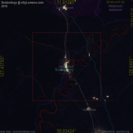
Analysis of Svobodnyy night lights 2016
Square area 10x10 km:
 0.42%
0.42%90-99
1.82%80-89
2.24%70-79
1.68%60-69
2.52%50-59
1.68%40-49
2.1%30-39
2.24%20-29
2.38%10-19
5.74%0-9
77.17%Square area 50x50 km:
0.03%90-99
0.12%80-89
0.11%70-79
0.06%60-69
0.09%50-59
0.14%40-49
0.17%30-39
0.11%20-29
0.16%10-19
0.28%0-9
98.73%Clear (daylight) street map image can be seen on geolist.org.
Map coordinates:
51° 48' 43.4" North, 127° 26' 16.3" East
51° 22' 30.9" North, 128° 8' 27.5" East
50° 56' 3.3" North, 128° 50' 38.8" East
Some cities around Svobodnyy sort by population:
• Blagoveshchensk
128.9 km =80.1 mi,  199°
199°
• Heihe, CN
133.8 km =83.1 mi, 199°
• Belogorsk
56.1 km =34.9 mi,  155°
155°
• Shimanovsk
77 km =47.8 mi,  335°
335°
• Seryshevo
35.5 km =22.1 mi,  151°
151°
• Yekaterinoslavka
130.5 km =81.1 mi, 148°
• Tsiolkovskiy
43.6 km =27.1 mi,  357°
357°
• Srednebelaya
80.2 km =49.8 mi,  186°
186°
2015833 (p: 61,017)
Sources (retrieved 2019-11-25):
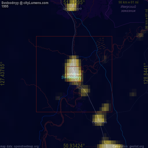
» NASA, Earths city lights 1995
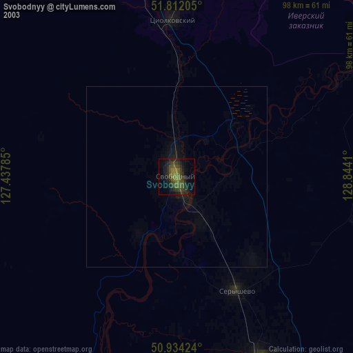
» NASA city lights 2003
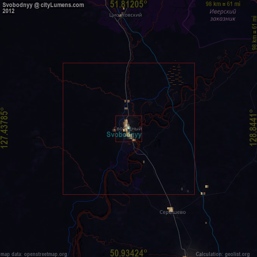
» Earth at Night: Flat Maps 2012, 2016