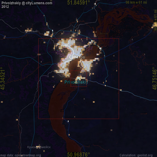
Privolzhskiy night lights from space
Night Light of Privolzhskiy (Saratovskaya Oblast) from space (Russia) Src. Average luminocity for 10x10km area is 24.6681% and for 50x50km: 12.7751%.
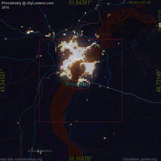
Analysis of Privolzhskiy night lights 2016
Square area 10x10 km:
 2.1%
2.1%90-99
2.1%80-89
1.82%70-79
1.96%60-69
6.3%50-59
5.18%40-49
3.5%30-39
1.82%20-29
10.36%10-19
33.75%0-9
31.09%Square area 50x50 km:
3.31%90-99
3.12%80-89
0.93%70-79
0.92%60-69
1.23%50-59
1.22%40-49
1.27%30-39
2.52%20-29
3.57%10-19
5.81%0-9
76.09%Clear (daylight) street map image can be seen on geolist.org.
Map coordinates:
51° 50' 45.3" North, 45° 20' 42.8" East
51° 24' 34" North, 46° 2' 54" East
50° 58' 7.5" North, 46° 45' 5.3" East
Some cities around Privolzhskiy sort by population:
• Saratov
14.8 km =9.2 mi,  349°
349°
• Engel’s
9.2 km =5.7 mi,  25°
25°
• Marks
58.9 km =36.6 mi,  55°
55°
• Krasnoarmeysk
49.4 km =30.7 mi,  209°
209°
• Stepnoye
55.7 km =34.6 mi,  93°
93°
• Svetlyy
41.2 km =25.6 mi,  315°
315°
• Tatishchevo
42.7 km =26.5 mi,  312°
312°
• Sokolovyy
23.1 km =14.4 mi, 319°
505057 (p: 31,849)
Sources (retrieved 2019-11-25):
» Earth at Night: Flat Maps 2012, 2016