Priob’ye night lights from space
Night Light of Priob’ye (Khanty-Mansia) from space (Russia) Src. Average luminocity for 10x10km area is 20.1443% and for 50x50km: 1.8117%.
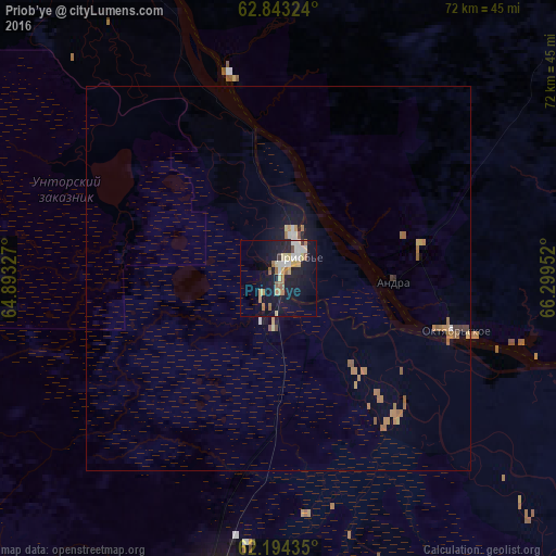
Analysis of Priob’ye night lights 2016
Square area 10x10 km:
 2.77%
2.77%90-99
3.16%80-89
2.67%70-79
3.36%60-69
2.87%50-59
2.96%40-49
0.4%30-39
0.79%20-29
2.27%10-19
24.51%0-9
54.25%Square area 50x50 km:
0.17%90-99
0.16%80-89
0.19%70-79
0.27%60-69
0.57%50-59
0.33%40-49
0.08%30-39
0.09%20-29
0.14%10-19
1.37%0-9
96.63%Clear (daylight) street map image can be seen on geolist.org.
Map coordinates:
62° 50' 35.7" North, 64° 53' 35.8" East
62° 31' 14" North, 65° 35' 47" East
62° 11' 39.7" North, 66° 17' 58.3" East
Some cities around Priob’ye sort by population:
• Khanty-Mansiysk
246 km =152.9 mi,  133°
133°
• Nyagan
43.5 km =27 mi,  193°
193°
• Yugorsk
179.2 km =111.3 mi,  221°
221°
• Sovetskiy
166.4 km =103.4 mi, 219°
• Beloyarskiy
143.1 km =88.9 mi,  22°
22°
• Igrim
95.6 km =59.4 mi,  321°
321°
• Berëzovo
160 km =99.4 mi,  350°
350°
• Pionerskiy
205.4 km =127.6 mi, 224°
1536757 (p: 7,400)
Sources (retrieved 2019-11-25):
» Earth at Night: Flat Maps 2012, 2016