Pogranichnyy night lights from space
Night Light of Pogranichnyy (Primorskiy (Maritime) Kray) from space (Russia) Src. Average luminocity for 10x10km area is 4.9397% and for 50x50km: 1.3306%.
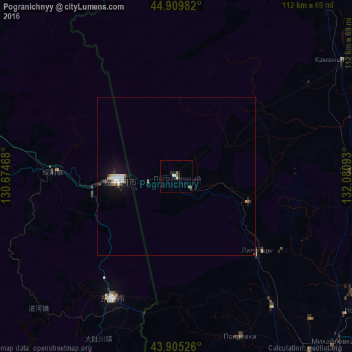
Analysis of Pogranichnyy night lights 2016
Square area 10x10 km:
 0.32%
0.32%90-99
1.27%80-89
0.95%70-79
0%60-69
0.16%50-59
0.63%40-49
0.48%30-39
1.59%20-29
1.75%10-19
1.75%0-9
91.11%Square area 50x50 km:
0.22%90-99
0.26%80-89
0.14%70-79
0.09%60-69
0.05%50-59
0.1%40-49
0.13%30-39
0.21%20-29
0.36%10-19
1.05%0-9
97.39%Clear (daylight) street map image can be seen on geolist.org.
Map coordinates:
44° 54' 35.4" North, 130° 40' 28.8" East
44° 24' 34.9" North, 131° 22' 40.1" East
43° 54' 18.9" North, 132° 4' 51.3" East
Some cities around Pogranichnyy sort by population:
• Dongning, CN
43.7 km =27.2 mi,  207°
207°
• Suifenhe, CN
18.3 km =11.4 mi,  266°
266°
• Kamen’-Rybolov
64.8 km =40.3 mi,  54°
54°
• Khorol’
55.5 km =34.5 mi,  88°
88°
• Pokrovka
54.7 km =34 mi,  158°
158°
• Yaroslavskiy
72.1 km =44.8 mi,  110°
110°
• Mikhaylovka
73.1 km =45.4 mi,  136°
136°
• Lipovtsy
36.1 km =22.4 mi,  130°
130°
2017851 (p: 11,930)
Sources (retrieved 2019-11-25):
» Earth at Night: Flat Maps 2012, 2016