Matveyev Kurgan night lights from space
Night Light of Matveyev Kurgan (Rostov) from space (Russia) Src. Average luminocity for 10x10km area is 7.331% and for 50x50km: 0.6365%.
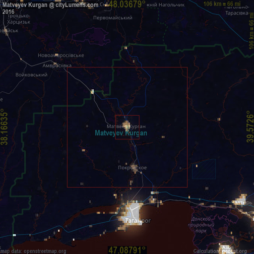
Analysis of Matveyev Kurgan night lights 2016
Square area 10x10 km:
 0%
0%90-99
0%80-89
0%70-79
1.14%60-69
3.13%50-59
2.7%40-49
2.7%30-39
0.57%20-29
1.14%10-19
0.57%0-9
88.07%Square area 50x50 km:
0.01%90-99
0.03%80-89
0%70-79
0.07%60-69
0.15%50-59
0.12%40-49
0.31%30-39
0.21%20-29
0.19%10-19
0.19%0-9
98.72%Clear (daylight) street map image can be seen on geolist.org.
Map coordinates:
48° 2' 12.4" North, 38° 9' 58.9" East
47° 33' 52.2" North, 38° 52' 10.1" East
47° 5' 16.5" North, 39° 34' 21.4" East
Some cities around Matveyev Kurgan sort by population:
• Taganrog
36.6 km =22.7 mi,  176°
176°
• Chystyakove, UA
56.5 km =35.1 mi,  338°
338°
• Snizhne, UA
51.8 km =32.2 mi,  351°
351°
• Amvrosiyivka, UA
38.8 km =24.1 mi,  310°
310°
• Persianovka
41.4 km =25.7 mi,  95°
95°
• Chaltyr
55.6 km =34.5 mi,  124°
124°
• Pokrovskoye
16.7 km =10.4 mi,  172°
172°
• Kuybyshevo
27.7 km =17.2 mi,  5°
5°
528495 (p: 14,342)
Sources (retrieved 2019-11-25):
» Earth at Night: Flat Maps 2012, 2016