Snizhne night lights from space
Night Light of Snizhne (Donetsk) from space (Ukraine) Src. Average luminocity for 10x10km area is 3.5156% and for 50x50km: 1.4132%.
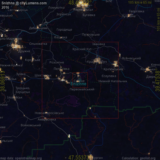
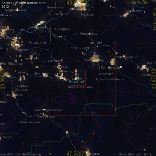
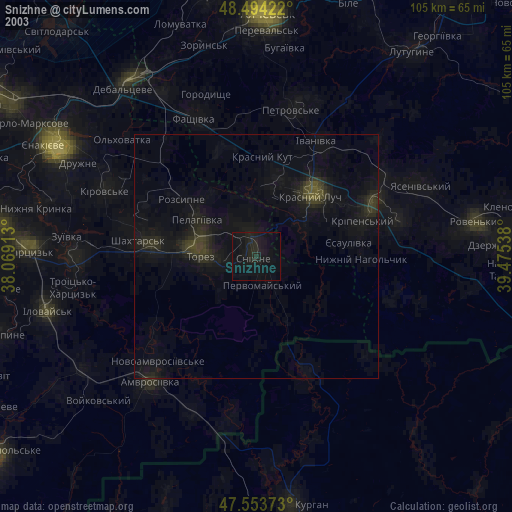
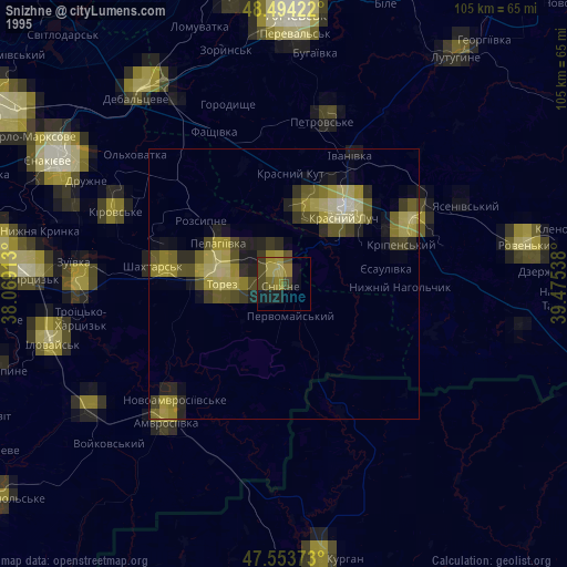
Analysis of Snizhne night lights 2016
Square area 10x10 km:
 0%
0%90-99
0%80-89
0%70-79
0%60-69
2.84%50-59
0.57%40-49
0.85%30-39
0.43%20-29
0.99%10-19
1.14%0-9
93.18%Square area 50x50 km:
0%90-99
0.05%80-89
0.06%70-79
0.21%60-69
0.37%50-59
0.28%40-49
0.55%30-39
0.45%20-29
0.38%10-19
0.31%0-9
97.35%Clear (daylight) street map image can be seen on geolist.org.
Map coordinates:
48° 29' 39.2" North, 38° 4' 8.9" East
48° 1' 34" North, 38° 46' 20.1" East
47° 33' 13.4" North, 39° 28' 31.4" East
Some cities around Snizhne sort by population:
• Krasnyy Luch
17.6 km =10.9 mi,  44°
44°
• Shakhtars’k
25.1 km =15.6 mi,  277°
277°
• Chystyakove
13.1 km =8.1 mi, 276°
• Antratsyt
25.7 km =16 mi,  67°
67°
• Amvrosiyivka
33.9 km =21.1 mi,  220°
220°
• Kripens’kyy
22 km =13.7 mi,  75°
75°
• Miusyns’k
11.3 km =7 mi,  59°
59°
• Kuybyshevo, RU
25.8 km =16 mi,  157°
157°
693381 (p: 55,587)
Sources (retrieved 2019-11-25):
» NASA, Earths city lights 1995
» NASA city lights 2003
» Earth at Night: Flat Maps 2012, 2016