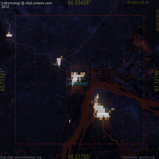
Labytnangi night lights from space
Night Light of Labytnangi (Yamalo-Nenets) from space (Russia) Src. Average luminocity for 10x10km area is 19.2811% and for 50x50km: 2.3958%.
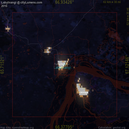
Analysis of Labytnangi night lights 2016
Square area 10x10 km:
 3.87%
3.87%90-99
4.88%80-89
1.6%70-79
1.35%60-69
2.69%50-59
0.76%40-49
1.01%30-39
1.18%20-29
0.59%10-19
25.84%0-9
56.23%Square area 50x50 km:
0.53%90-99
0.56%80-89
0.1%70-79
0.1%60-69
0.31%50-59
0.15%40-49
0.16%30-39
0.16%20-29
0.49%10-19
2.4%0-9
95.03%Clear (daylight) street map image can be seen on geolist.org.
Map coordinates:
66° 56' 3.3" North, 65° 42' 54.8" East
66° 39' 26" North, 66° 25' 6" East
66° 22' 37.4" North, 67° 7' 17.3" East
Some cities around Labytnangi sort by population:
• Vorkuta
138.7 km =86.2 mi,  312°
312°
• Nadym
301.7 km =187.5 mi,  114°
114°
• Salekhard
16.3 km =10.1 mi,  150°
150°
• Beloyarskiy
327.7 km =203.6 mi,  177°
177°
• Vorgashor
153.2 km =95.2 mi, 312°
• Pangody
371.9 km =231.1 mi,  103°
103°
• Kharp
31.2 km =19.4 mi,  300°
300°
• Berëzovo
309 km =192 mi,  191°
191°
1500933 (p: 27,067)
Sources (retrieved 2019-11-25):
» Earth at Night: Flat Maps 2012, 2016