Pangody night lights from space
Night Light of Pangody (Yamalo-Nenets) from space (Russia) Src. Average luminocity for 10x10km area is 7.0131% and for 50x50km: 0.4164%.
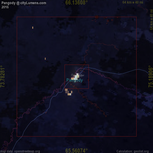
Analysis of Pangody night lights 2016
Square area 10x10 km:
 1.4%
1.4%90-99
1.22%80-89
1.31%70-79
0.96%60-69
0%50-59
0%40-49
0.17%30-39
0.44%20-29
1.14%10-19
0.79%0-9
92.57%Square area 50x50 km:
0.06%90-99
0.06%80-89
0.06%70-79
0.07%60-69
0.03%50-59
0.08%40-49
0.01%30-39
0.02%20-29
0.05%10-19
0.05%0-9
99.52%Clear (daylight) street map image can be seen on geolist.org.
Map coordinates:
66° 8' 9.9" North, 73° 46' 58.1" East
65° 51' 0.1" North, 74° 29' 9.3" East
65° 33' 38.7" North, 75° 11' 20.6" East
Some cities around Pangody sort by population:
• Novyy Urengoy
100.6 km =62.5 mi,  75°
75°
• Nadym
96.8 km =60.1 mi,  248°
248°
• Muravlenko
229.1 km =142.4 mi,  179°
179°
• Gubkinskiy
183.5 km =114 mi,  149°
149°
• Tarko-Sale
184.3 km =114.5 mi,  124°
124°
• Urengoy
176.7 km =109.8 mi,  85°
85°
• Purpe
183.8 km =114.2 mi, 145°
• Korotchaevo
169.3 km =105.2 mi, 87°
1495626 (p: 10,898)
Sources (retrieved 2019-11-25):
» Earth at Night: Flat Maps 2012, 2016