Vorkuta night lights from space
Night Light of Vorkuta (Komi) from space (Russia) Src. Average luminocity for 10x10km area is 26.54% and for 50x50km: 1.5011%.
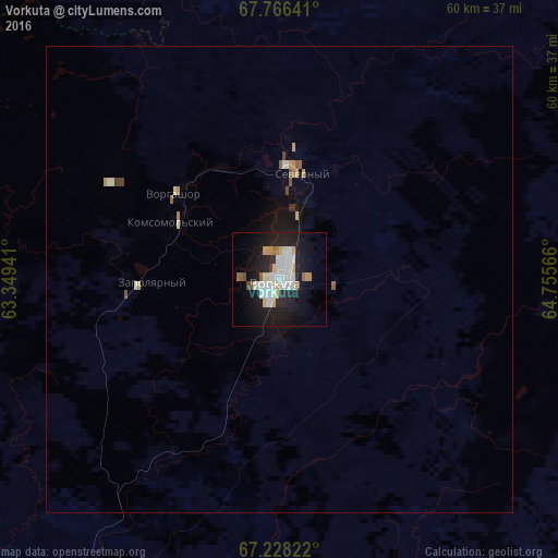
Analysis of Vorkuta night lights 2016
Square area 10x10 km:
 6.38%
6.38%90-99
7.57%80-89
2.3%70-79
2.47%60-69
1.79%50-59
0.94%40-49
1.02%30-39
0.34%20-29
7.82%10-19
25.43%0-9
43.96%Square area 50x50 km:
0.28%90-99
0.34%80-89
0.13%70-79
0.16%60-69
0.14%50-59
0.11%40-49
0.12%30-39
0.05%20-29
0.32%10-19
1.41%0-9
96.94%Clear (daylight) street map image can be seen on geolist.org.
Map coordinates:
67° 45' 59.1" North, 63° 20' 57.9" East
67° 29' 55.8" North, 64° 3' 9.1" East
67° 13' 41.6" North, 64° 45' 20.4" East
Some cities around Vorkuta sort by population:
• Nadym
433.5 km =269.4 mi,  120°
120°
• Pechora
401.3 km =249.4 mi,  229°
229°
• Usinsk
331.5 km =206 mi,  239°
239°
• Salekhard
154.4 km =95.9 mi,  134°
134°
• Labytnangi
138.7 km =86.2 mi, 132°
• Vorgashor
14.5 km =9 mi,  310°
310°
• Kharp
108.4 km =67.4 mi,  135°
135°
• Berëzovo
398.5 km =247.6 mi,  173°
173°
1486910 (p: 80,039)
Sources (retrieved 2019-11-25):
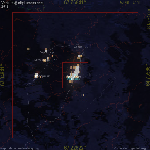
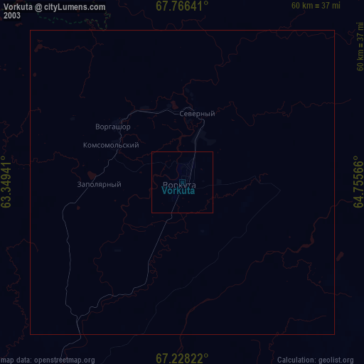
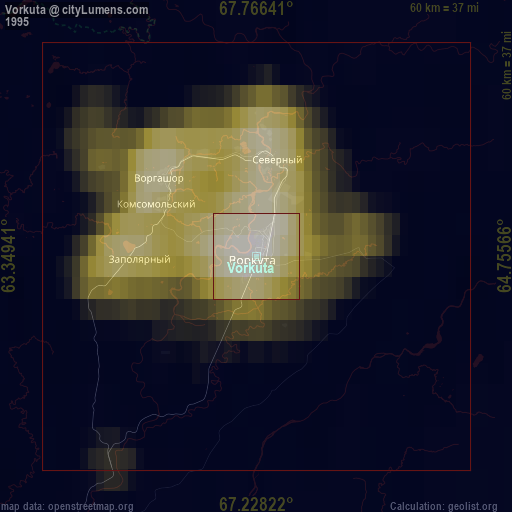
» NASA, Earths city lights 1995
» NASA city lights 2003
» Earth at Night: Flat Maps 2012, 2016