Vorgashor night lights from space
Night Light of Vorgashor (Komi) from space (Russia) Src. Average luminocity for 10x10km area is 1.4035% and for 50x50km: 1.4683%.
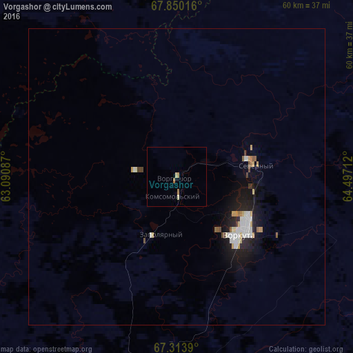
Analysis of Vorgashor night lights 2016
Square area 10x10 km:
 0%
0%90-99
0.17%80-89
0.5%70-79
0%60-69
0.92%50-59
0.08%40-49
0%30-39
0%20-29
0%10-19
0%0-9
98.33%Square area 50x50 km:
0.27%90-99
0.33%80-89
0.13%70-79
0.16%60-69
0.14%50-59
0.11%40-49
0.12%30-39
0.05%20-29
0.31%10-19
1.38%0-9
97.01%Clear (daylight) street map image can be seen on geolist.org.
Map coordinates:
67° 51' 0.6" North, 63° 5' 27.1" East
67° 35' 0.8" North, 63° 47' 38.4" East
67° 18' 50" North, 64° 29' 49.6" East
Some cities around Vorgashor sort by population:
• Vorkuta
14.5 km =9 mi,  130°
130°
• Nadym
447.6 km =278.1 mi,  120°
120°
• Pechora
398.6 km =247.7 mi,  227°
227°
• Usinsk
326.3 km =202.8 mi,  237°
237°
• Salekhard
168.9 km =104.9 mi, 133°
• Labytnangi
153.2 km =95.2 mi, 132°
• Kharp
122.9 km =76.4 mi,  135°
135°
• Berëzovo
409.3 km =254.3 mi,  172°
172°
1486913 (p: 18,946)
Sources (retrieved 2019-11-25):
» Earth at Night: Flat Maps 2012, 2016