Kyzburun Pervyy night lights from space
Night Light of Kyzburun Pervyy (Kabardino-Balkariya Republic) from space (Russia) Src. Average luminocity for 10x10km area is 5.9242% and for 50x50km: 5.342%.
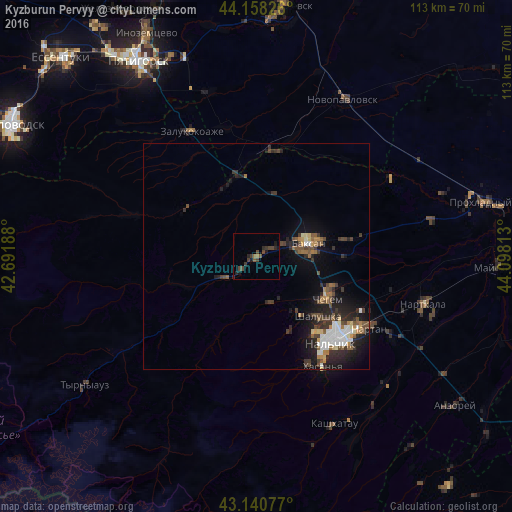
Analysis of Kyzburun Pervyy night lights 2016
Square area 10x10 km:
 0%
0%90-99
0%80-89
0%70-79
0%60-69
1.21%50-59
1.21%40-49
4.24%30-39
2.42%20-29
2.58%10-19
2.88%0-9
85.45%Square area 50x50 km:
0.79%90-99
0.66%80-89
0.38%70-79
0.38%60-69
0.6%50-59
0.9%40-49
1.2%30-39
1.22%20-29
1.93%10-19
3.8%0-9
88.14%Clear (daylight) street map image can be seen on geolist.org.
Map coordinates:
44° 9' 29.7" North, 42° 41' 30.8" East
43° 39' 6" North, 43° 23' 42" East
43° 8' 26.8" North, 44° 5' 53.3" East
Some cities around Kyzburun Pervyy sort by population:
• Baksan
12.1 km =7.5 mi,  70°
70°
• Dugulubgey
11.5 km =7.1 mi,  83°
83°
• Chegem Vtoroy
17.6 km =10.9 mi,  110°
110°
• Islamey
5.5 km =3.4 mi,  61°
61°
• Zayukovo
6.3 km =3.9 mi,  231°
231°
• Sarmakovo
18.8 km =11.7 mi,  303°
303°
• Malka
17.9 km =11.1 mi,  341°
341°
• Gundelen
18.9 km =11.7 mi,  251°
251°
537346 (p: 5,833)
Sources (retrieved 2019-11-25):
» Earth at Night: Flat Maps 2012, 2016