Dugulubgey night lights from space
Night Light of Dugulubgey (Kabardino-Balkariya Republic) from space (Russia) Src. Average luminocity for 10x10km area is 21.9121% and for 50x50km: 5.4567%.
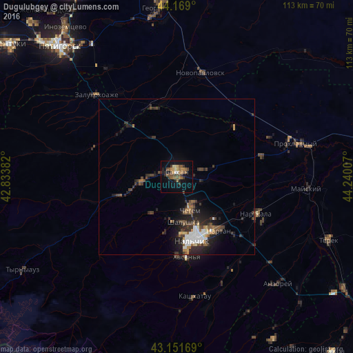
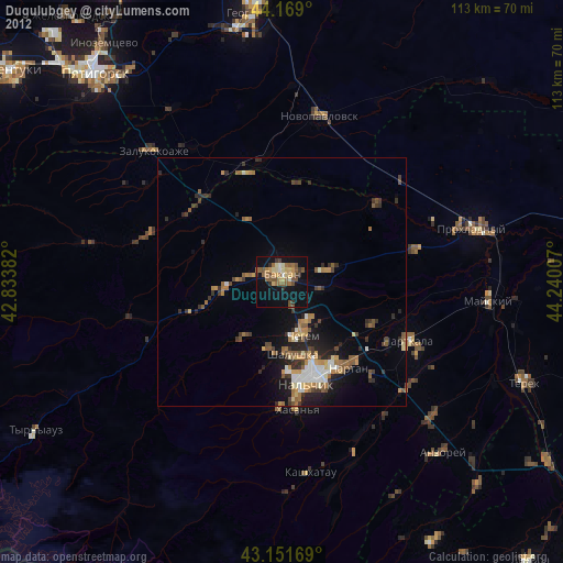
Analysis of Dugulubgey night lights 2016
Square area 10x10 km:
 0.3%
0.3%90-99
1.82%80-89
1.97%70-79
3.33%60-69
4.24%50-59
6.67%40-49
5.45%30-39
3.48%20-29
3.33%10-19
16.52%0-9
52.88%Square area 50x50 km:
0.79%90-99
0.64%80-89
0.36%70-79
0.43%60-69
0.6%50-59
0.92%40-49
1.25%30-39
1.3%20-29
1.98%10-19
3.6%0-9
88.12%Clear (daylight) street map image can be seen on geolist.org.
Map coordinates:
44° 10' 8.4" North, 42° 50' 1.8" East
43° 39' 45" North, 43° 32' 13" East
43° 9' 6.1" North, 44° 14' 24.3" East
Some cities around Dugulubgey sort by population:
• Baksan
2.8 km =1.7 mi,  0°
0°
• Chegem
12.4 km =7.7 mi,  158°
158°
• Shalushka
14.6 km =9.1 mi,  170°
170°
• Chegem Vtoroy
9 km =5.6 mi,  145°
145°
• Islamey
6.7 km =4.2 mi,  282°
282°
• Zayukovo
17.1 km =10.6 mi,  252°
252°
• Baksanenok
9.9 km =6.2 mi,  72°
72°
• Kyzburun Pervyy
11.5 km =7.1 mi,  263°
263°
537345 (p: 20,965)
Sources (retrieved 2019-11-25):
» Earth at Night: Flat Maps 2012, 2016