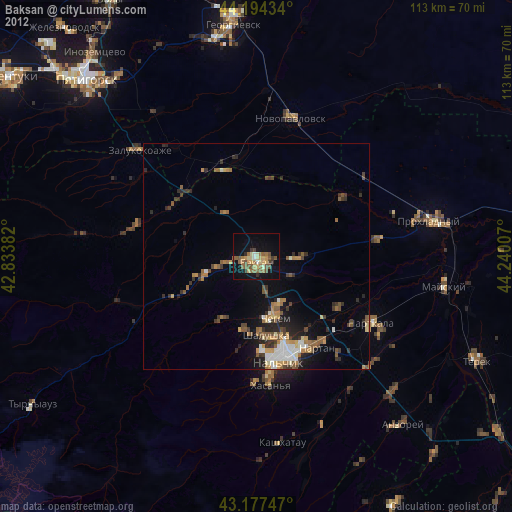
Baksan night lights from space
Night Light of Baksan (Kabardino-Balkariya Republic) from space (Russia) Src. Average luminocity for 10x10km area is 21.2864% and for 50x50km: 5.0648%.
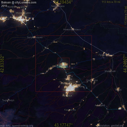
Analysis of Baksan night lights 2016
Square area 10x10 km:
 0.3%
0.3%90-99
1.82%80-89
1.97%70-79
3.33%60-69
4.24%50-59
6.52%40-49
5.3%30-39
3.18%20-29
3.33%10-19
14.85%0-9
55.15%Square area 50x50 km:
0.79%90-99
0.59%80-89
0.34%70-79
0.37%60-69
0.56%50-59
0.9%40-49
1.24%30-39
1.2%20-29
1.6%10-19
3.04%0-9
89.38%Clear (daylight) street map image can be seen on geolist.org.
Map coordinates:
44° 11' 39.6" North, 42° 50' 1.8" East
43° 41' 17" North, 43° 32' 13" East
43° 10' 38.9" North, 44° 14' 24.3" East
Some cities around Baksan sort by population:
• Dugulubgey
2.8 km =1.7 mi,  180°
180°
• Chegem
15.1 km =9.4 mi,  162°
162°
• Shalushka
17.5 km =10.9 mi,  172°
172°
• Chegem Vtoroy
11.4 km =7.1 mi,  153°
153°
• Islamey
6.7 km =4.2 mi,  258°
258°
• Kenzhe
20.8 km =12.9 mi, 175°
• Zayukovo
18.2 km =11.3 mi,  243°
243°
• Kyzburun Pervyy
12.1 km =7.5 mi,  250°
250°
579574 (p: 37,519)
Sources (retrieved 2019-11-25):
» Earth at Night: Flat Maps 2012, 2016