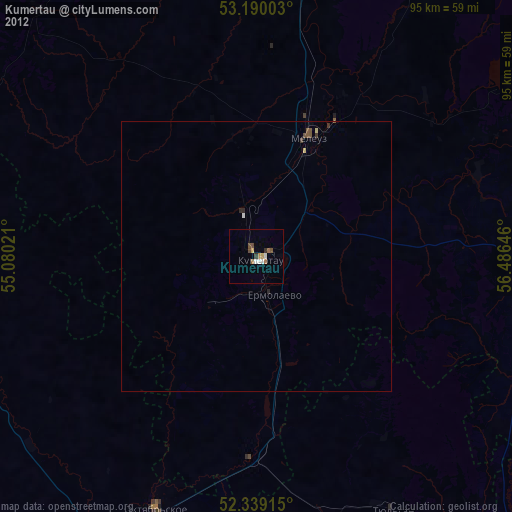
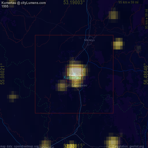
Kumertau night lights from space
Night Light of Kumertau (Bashkortostan Republic) from space (Russia) Src. Average luminocity for 10x10km area is 13.1301% and for 50x50km: 1.457%.
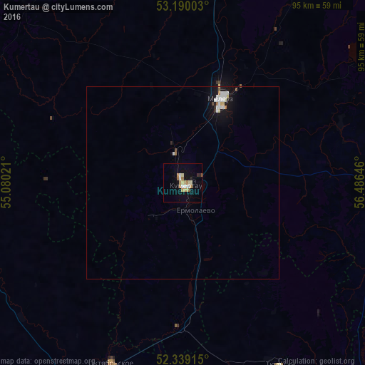

Analysis of Kumertau night lights 2016
Square area 10x10 km:
 1.52%
1.52%90-99
2.27%80-89
1.64%70-79
2.4%60-69
2.9%50-59
0.63%40-49
0%30-39
0.51%20-29
1.01%10-19
5.3%0-9
81.82%Square area 50x50 km:
0.31%90-99
0.31%80-89
0.15%70-79
0.12%60-69
0.18%50-59
0.1%40-49
0.04%30-39
0.03%20-29
0.09%10-19
1.19%0-9
97.48%Clear (daylight) street map image can be seen on geolist.org.
Map coordinates:
53° 11' 24.1" North, 55° 4' 48.8" East
52° 46' 0" North, 55° 46' 60" East
52° 20' 20.9" North, 56° 29' 11.3" East
Some cities around Kumertau sort by population:
• Salavat
69.1 km =42.9 mi,  6°
6°
• Ishimbay
78.4 km =48.7 mi, 12°
• Meleuz
24.2 km =15 mi,  24°
24°
• Tyul’gan
54 km =33.6 mi,  151°
151°
• Mrakovo
56.9 km =35.4 mi,  95°
95°
• Sharlyk
71.4 km =44.4 mi,  283°
283°
• Yermolayevo
5.7 km =3.5 mi,  168°
168°
• Yumaguzino
43.7 km =27.2 mi,  69°
69°
539283 (p: 65,321)
Sources (retrieved 2019-11-25):
» NASA, Earths city lights 1995
» NASA city lights 2003
» Earth at Night: Flat Maps 2012, 2016