Inozemtsevo night lights from space
Night Light of Inozemtsevo (Stavropol’ Kray) from space (Russia) Src. Average luminocity for 10x10km area is 27.6727% and for 50x50km: 6.8656%.
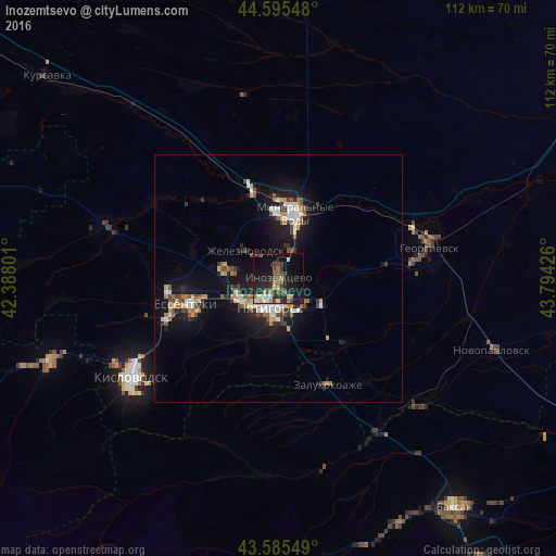
Analysis of Inozemtsevo night lights 2016
Square area 10x10 km:
 2.42%
2.42%90-99
3.64%80-89
2.42%70-79
3.03%60-69
3.48%50-59
3.18%40-49
6.97%30-39
6.36%20-29
12.12%10-19
25.76%0-9
30.61%Square area 50x50 km:
0.78%90-99
1.13%80-89
0.55%70-79
0.73%60-69
0.79%50-59
0.98%40-49
1.01%30-39
0.9%20-29
1.49%10-19
7.14%0-9
84.5%Clear (daylight) street map image can be seen on geolist.org.
Map coordinates:
44° 35' 43.7" North, 42° 23' 16.8" East
44° 5' 33.5" North, 43° 5' 28.1" East
43° 35' 7.8" North, 43° 47' 39.3" East
Some cities around Inozemtsevo sort by population:
• Pyatigorsk
5.5 km =3.4 mi,  207°
207°
• Mineralnye Vody
13.5 km =8.4 mi,  15°
15°
• Goryachevodskiy
7.7 km =4.8 mi,  179°
179°
• Zheleznovodsk
7.7 km =4.8 mi,  312°
312°
• Lermontov
9.5 km =5.9 mi,  279°
279°
• Svobody
8.1 km =5 mi,  203°
203°
• Vinsady
10.1 km =6.3 mi,  262°
262°
• Konstantinovskaya
7.5 km =4.7 mi,  134°
134°
556320 (p: 28,779)
Sources (retrieved 2019-11-25):
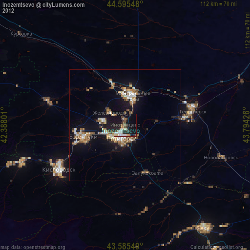
» Earth at Night: Flat Maps 2012, 2016