Mineralnye Vody night lights from space
Night Light of Mineralnye Vody (Stavropol’ Kray) from space (Russia) Src. Average luminocity for 10x10km area is 34.3788% and for 50x50km: 6.5072%.
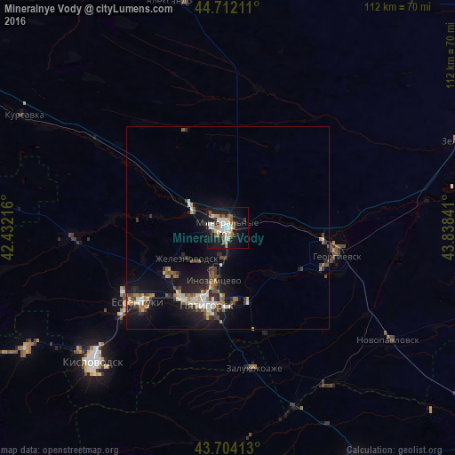
Analysis of Mineralnye Vody night lights 2016
Square area 10x10 km:
 6.97%
6.97%90-99
8.64%80-89
1.97%70-79
3.48%60-69
3.33%50-59
6.52%40-49
1.21%30-39
2.42%20-29
6.97%10-19
34.7%0-9
23.79%Square area 50x50 km:
0.73%90-99
1.08%80-89
0.5%70-79
0.68%60-69
0.77%50-59
0.94%40-49
1%30-39
0.99%20-29
1.46%10-19
6.73%0-9
85.13%Clear (daylight) street map image can be seen on geolist.org.
Map coordinates:
44° 42' 43.6" North, 42° 25' 55.8" East
44° 12' 37" North, 43° 8' 7" East
43° 42' 14.9" North, 43° 50' 18.3" East
Some cities around Mineralnye Vody sort by population:
• Inozemtsevo
13.5 km =8.4 mi,  195°
195°
• Zheleznovodsk
12.1 km =7.5 mi,  229°
229°
• Lermontov
17.3 km =10.7 mi, 228°
• Aleksandriyskaya
16.8 km =10.4 mi,  83°
83°
• Lysogorskaya
16.1 km =10 mi,  135°
135°
• Konstantinovskaya
18.4 km =11.4 mi,  174°
174°
• Andzhiyevskiy
5.1 km =3.2 mi,  308°
308°
• Levokumka
2.7 km =1.7 mi,  26°
26°
526480 (p: 76,280)
Sources (retrieved 2019-11-25):
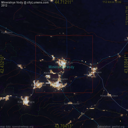
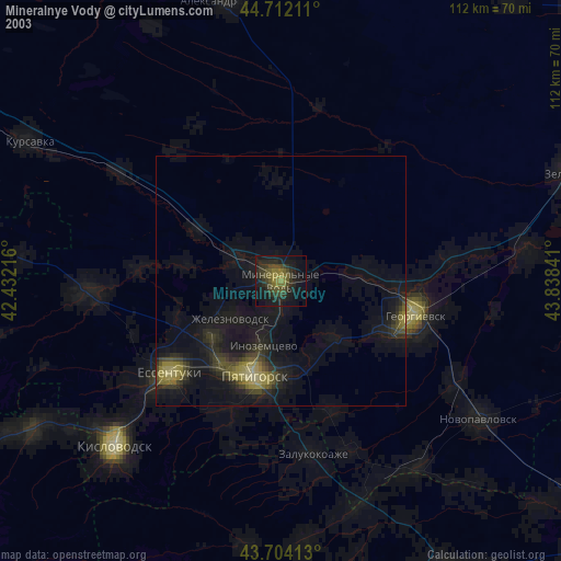
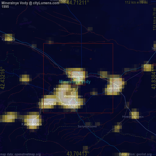
» NASA, Earths city lights 1995
» NASA city lights 2003
» Earth at Night: Flat Maps 2012, 2016