Glubokiy night lights from space
Night Light of Glubokiy (Rostov) from space (Russia) Src. Average luminocity for 10x10km area is 14.1151% and for 50x50km: 2.8245%.
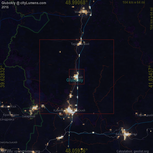
Analysis of Glubokiy night lights 2016
Square area 10x10 km:
 2.56%
2.56%90-99
2.56%80-89
2.13%70-79
0.71%60-69
1.99%50-59
1.42%40-49
0.57%30-39
1.14%20-29
0.43%10-19
7.1%0-9
79.4%Square area 50x50 km:
0.49%90-99
0.48%80-89
0.25%70-79
0.28%60-69
0.3%50-59
0.31%40-49
0.31%30-39
0.54%20-29
0.37%10-19
1.71%0-9
94.96%Clear (daylight) street map image can be seen on geolist.org.
Map coordinates:
48° 59' 26.4" North, 39° 37' 42" East
48° 31' 37.8" North, 40° 19' 53.2" East
48° 3' 33.7" North, 41° 2' 4.5" East
Some cities around Glubokiy sort by population:
• Kamensk-Shakhtinskiy
23.9 km =14.9 mi,  192°
192°
• Donetsk
34.5 km =21.4 mi,  232°
232°
• Millerovo
44.2 km =27.5 mi,  6°
6°
• Likhovskoy
43.2 km =26.8 mi,  195°
195°
• Tarasovskiy
22.4 km =13.9 mi, 5°
• Masalovka
14.7 km =9.1 mi, 200°
• Koksovyy
43.3 km =26.9 mi,  147°
147°
• Staraya Stanitsa
20.4 km =12.7 mi, 187°
561146 (p: 11,225)
Sources (retrieved 2019-11-25):
» Earth at Night: Flat Maps 2012, 2016