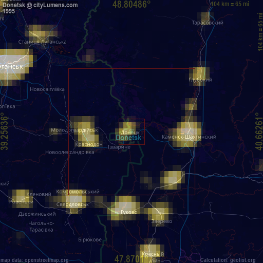
Donetsk night lights from space
Night Light of Donetsk (Rostov) from space (Russia) Src. Average luminocity for 10x10km area is 17.3338% and for 50x50km: 3.1746%.
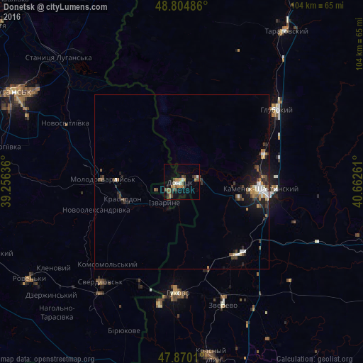
Analysis of Donetsk night lights 2016
Square area 10x10 km:
 1.42%
1.42%90-99
1.99%80-89
0.28%70-79
4.12%60-69
2.41%50-59
4.12%40-49
3.13%30-39
3.13%20-29
2.13%10-19
6.11%0-9
71.16%Square area 50x50 km:
0.38%90-99
0.41%80-89
0.18%70-79
0.39%60-69
0.34%50-59
0.55%40-49
0.59%30-39
0.65%20-29
0.74%10-19
1.97%0-9
93.79%Clear (daylight) street map image can be seen on geolist.org.
Map coordinates:
48° 48' 17.5" North, 39° 15' 22.9" East
48° 20' 22.6" North, 39° 57' 34.1" East
47° 52' 12.4" North, 40° 39' 45.4" East
Some cities around Donetsk sort by population:
• Kamensk-Shakhtinskiy
22.3 km =13.9 mi,  96°
96°
• Gukovo
30.9 km =19.2 mi,  183°
183°
• Sorokyne, UA
17.1 km =10.6 mi,  252°
252°
• Molodohvardiys’k, UA
22.7 km =14.1 mi,  271°
271°
• Likhovskoy
26.5 km =16.5 mi,  142°
142°
• Masalovka
23.4 km =14.5 mi,  72°
72°
• Staraya Stanitsa
24.7 km =15.3 mi,  88°
88°
• Teple, UA
29.5 km =18.3 mi,  264°
264°
565348 (p: 50,850)
Sources (retrieved 2019-11-25):
» NASA, Earths city lights 1995
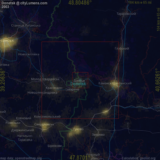
» NASA city lights 2003
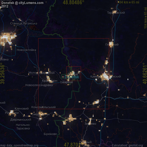
» Earth at Night: Flat Maps 2012, 2016