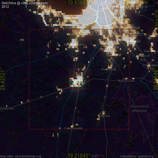
Gatchina night lights from space
Night Light of Gatchina (Leningradskaya Oblast') from space (Russia) Src. Average luminocity for 10x10km area is 44.3571% and for 50x50km: 14.8118%.

Analysis of Gatchina night lights 2016
Square area 10x10 km:
 14.4%
14.4%90-99
14.06%80-89
3.63%70-79
2.49%60-69
0.79%50-59
0.91%40-49
0.79%30-39
2.61%20-29
16.33%10-19
29.48%0-9
14.51%Square area 50x50 km:
3.67%90-99
3.59%80-89
1.28%70-79
1.5%60-69
1.04%50-59
1.36%40-49
0.69%30-39
1.95%20-29
4.08%10-19
8.01%0-9
72.84%Clear (daylight) street map image can be seen on geolist.org.
Map coordinates:
59° 55' 50.1" North, 29° 25' 30.8" East
59° 34' 35" North, 30° 7' 42" East
59° 13' 6.4" North, 30° 49' 53.3" East
Some cities around Gatchina sort by population:
• Pushkin
21.5 km =13.4 mi,  44°
44°
• Krasnoye Selo
18.1 km =11.2 mi,  353°
353°
• Gorelovo
21.8 km =13.5 mi,  0°
0°
• Kommunar
15.5 km =9.6 mi,  71°
71°
• Pavlovsk
20.9 km =13 mi,  55°
55°
• Siverskiy
24.8 km =15.4 mi,  186°
186°
• Vyritsa
22.5 km =14 mi,  146°
146°
• Mariyenburg
3.6 km =2.2 mi,  261°
261°
561887 (p: 89,761)
Sources (retrieved 2019-11-25):
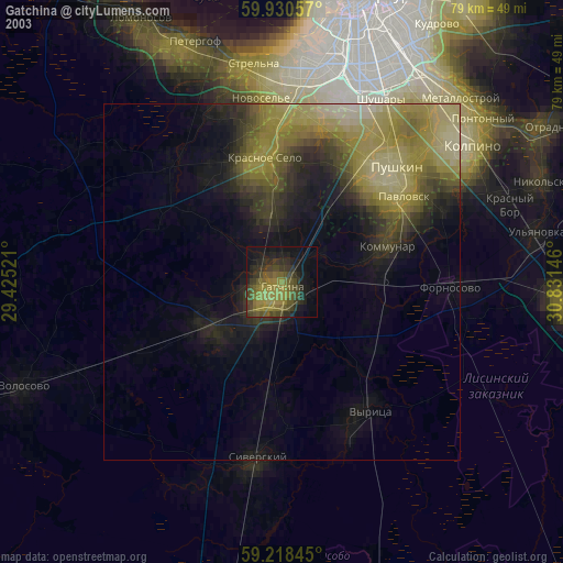
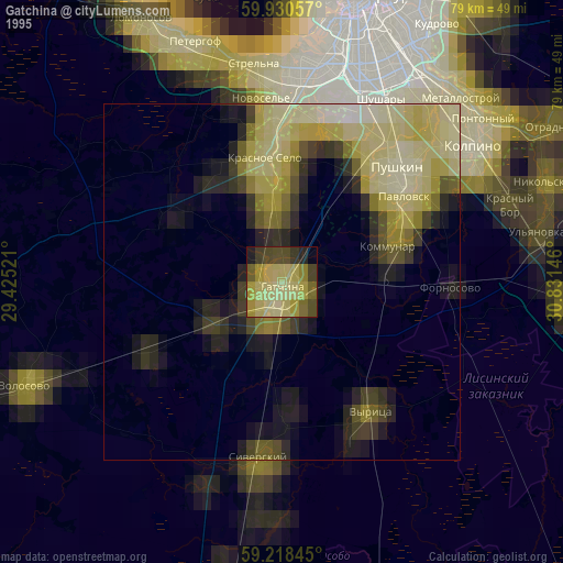
» NASA, Earths city lights 1995
» NASA city lights 2003
» Earth at Night: Flat Maps 2012, 2016