Chegem night lights from space
Night Light of Chegem (Kabardino-Balkariya Republic) from space (Russia) Src. Average luminocity for 10x10km area is 0% and for 50x50km: 0.0397%.
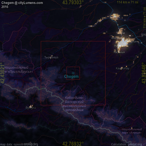
Analysis of Chegem night lights 2016
Square area 10x10 km:
 0%
0%90-99
0%80-89
0%70-79
0%60-69
0%50-59
0%40-49
0%30-39
0%20-29
0%10-19
0%0-9
100%Square area 50x50 km:
0%90-99
0%80-89
0%70-79
0%60-69
0%50-59
0%40-49
0.05%30-39
0.02%20-29
0.02%10-19
0.01%0-9
99.9%Clear (daylight) street map image can be seen on geolist.org.
Map coordinates:
43° 47' 34.9" North, 42° 25' 48.8" East
43° 33' 31" North, 43° 35' 34.3" East
42° 46' 9.6" North, 43° 50' 11.3" East
Some cities around Chegem sort by population:
• Nal’chik
7.1 km =4.4 mi,  162°
162°
• Baksan
15.1 km =9.4 mi,  342°
342°
• Dugulubgey
12.4 km =7.7 mi, 338°
• Nartan
10.1 km =6.3 mi,  121°
121°
• Shalushka
3.6 km =2.2 mi,  216°
216°
• Kenzhe
7 km =4.3 mi,  204°
204°
• Baksanenok
15.4 km =9.6 mi,  18°
18°
• Urvan’
15.4 km =9.6 mi, 118°
569639 (p: 18,429)
Sources (retrieved 2019-11-25):
» Earth at Night: Flat Maps 2012, 2016