Kovačica night lights from space
Night Light of Kovačica (Vojvodina) from space (Serbia) Src. Average luminocity for 10x10km area is 6.6712% and for 50x50km: 6.6503%.
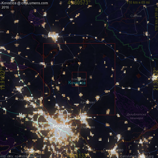
Analysis of Kovačica night lights 2016
Square area 10x10 km:
 0.45%
0.45%90-99
0.15%80-89
0%70-79
0.61%60-69
0%50-59
3.94%40-49
4.24%30-39
1.06%20-29
0.45%10-19
0.61%0-9
88.48%Square area 50x50 km:
0.49%90-99
0.88%80-89
0.61%70-79
0.76%60-69
0.86%50-59
1.04%40-49
1.05%30-39
0.99%20-29
2.37%10-19
4.74%0-9
86.21%Clear (daylight) street map image can be seen on geolist.org.
Map coordinates:
45° 36' 20.6" North, 19° 55' 5.8" East
45° 6' 42" North, 20° 37' 17" East
44° 36' 47.9" North, 21° 19' 28.3" East
Some cities around Kovačica sort by population:
• Pančevo
26.7 km =16.6 mi,  176°
176°
• Debeljača
4.8 km =3 mi,  198°
198°
• Padina
8.5 km =5.3 mi,  83°
83°
• Banatski Karlovac
31.9 km =19.8 mi,  102°
102°
• Titel
27.7 km =17.2 mi,  292°
292°
• Crepaja
11.4 km =7.1 mi,  173°
173°
• Ečka
27.4 km =17 mi,  329°
329°
• Vladimirovac
21.2 km =13.2 mi,  115°
115°
789178 (p: 7,357)
Sources (retrieved 2019-11-25):
» Earth at Night: Flat Maps 2012, 2016